
Cold front lit up severe storms east while Bertha and heat pressed the South
A deep summer low dragged a cold front into the East for severe storms and flooding while Tropical Storm Bertha closed on the Gulf Coast and heat built across the South.
A cold front trailing from an unseasonably deep low over the Upper Great Lakes touched off scattered severe storms and flash flooding from the Mid-South into the Northeast on July 21, 2026. Along the Gulf, Tropical Storm Bertha tracked west toward Louisiana, monsoon storms fired over the Southwest, and a subtropical ridge baked the Southern Plains and Southeast.
Deep low anchored the pattern over the Upper Great Lakes
The day pivoted on an unseasonably deep low grinding across the Upper Great Lakes, its trough at 500mb carving southward over the Great Lakes and Northeast. Ahead of the trailing cold front, the flow pumped warm, moist air north into the East. Behind it, cooler air spilled in across the Upper Midwest, Great Lakes, and Northeast. To the south, a stout subtropical ridge held its ground and kept the heat locked in over the Southern Plains and Southeast.
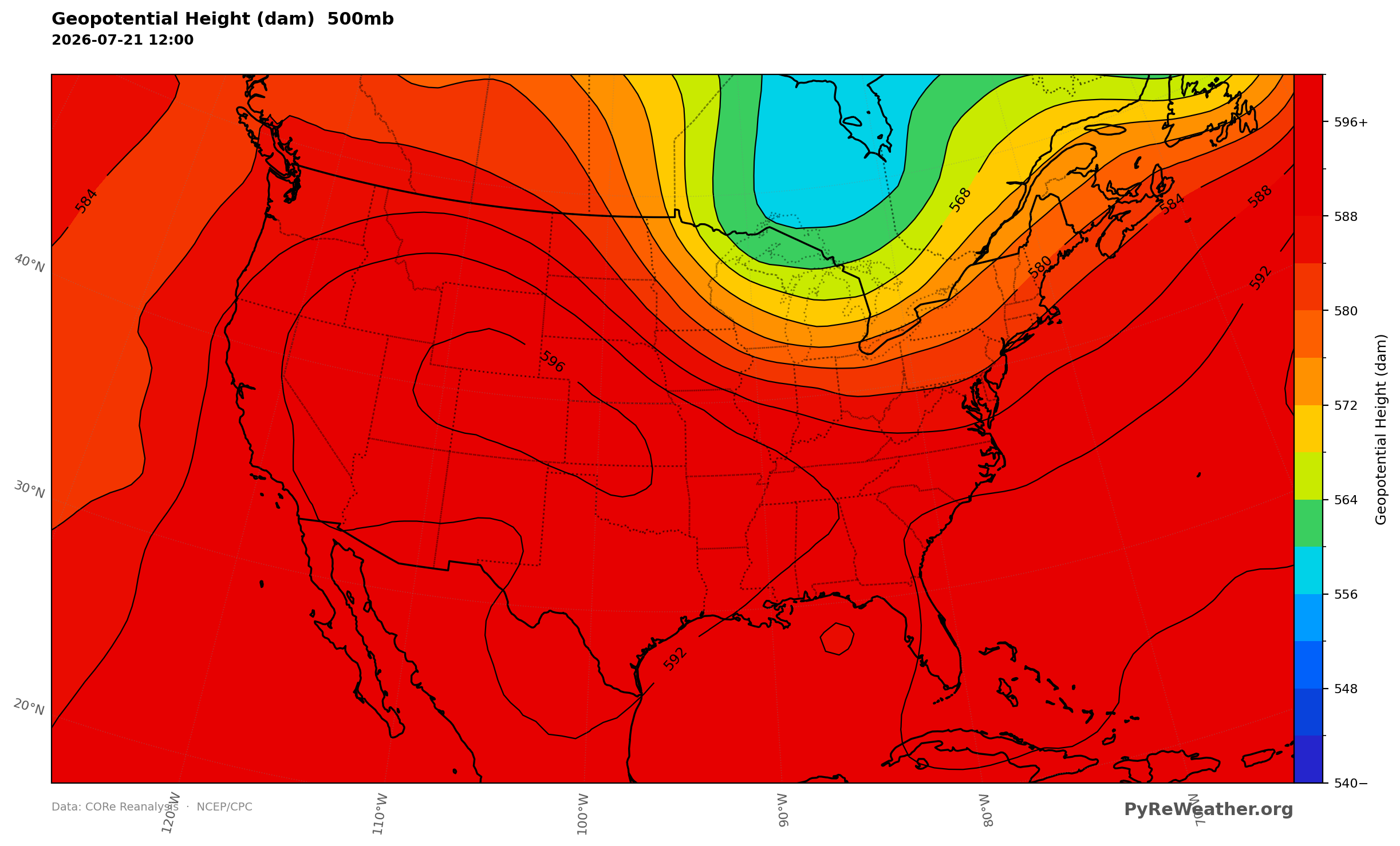
A trough dug over the Upper Great Lakes and Northeast while a ridge held firm across the South.
Severe storms and flash flooding from the Mid-South to the Northeast
As the cold front pressed southeast, a moist and unstable airmass piled up ahead of it, with surface-based CAPE running high from the Mid-South into the Northeast. That fuel fed thunderstorms that turned severe through the afternoon, with damaging wind gusts and flash flooding the main threats and a few tornadoes and large hail possible. Rain rates climbed sharply along the boundary, and slow storm motions let water pile up where cells kept crossing the same ground.
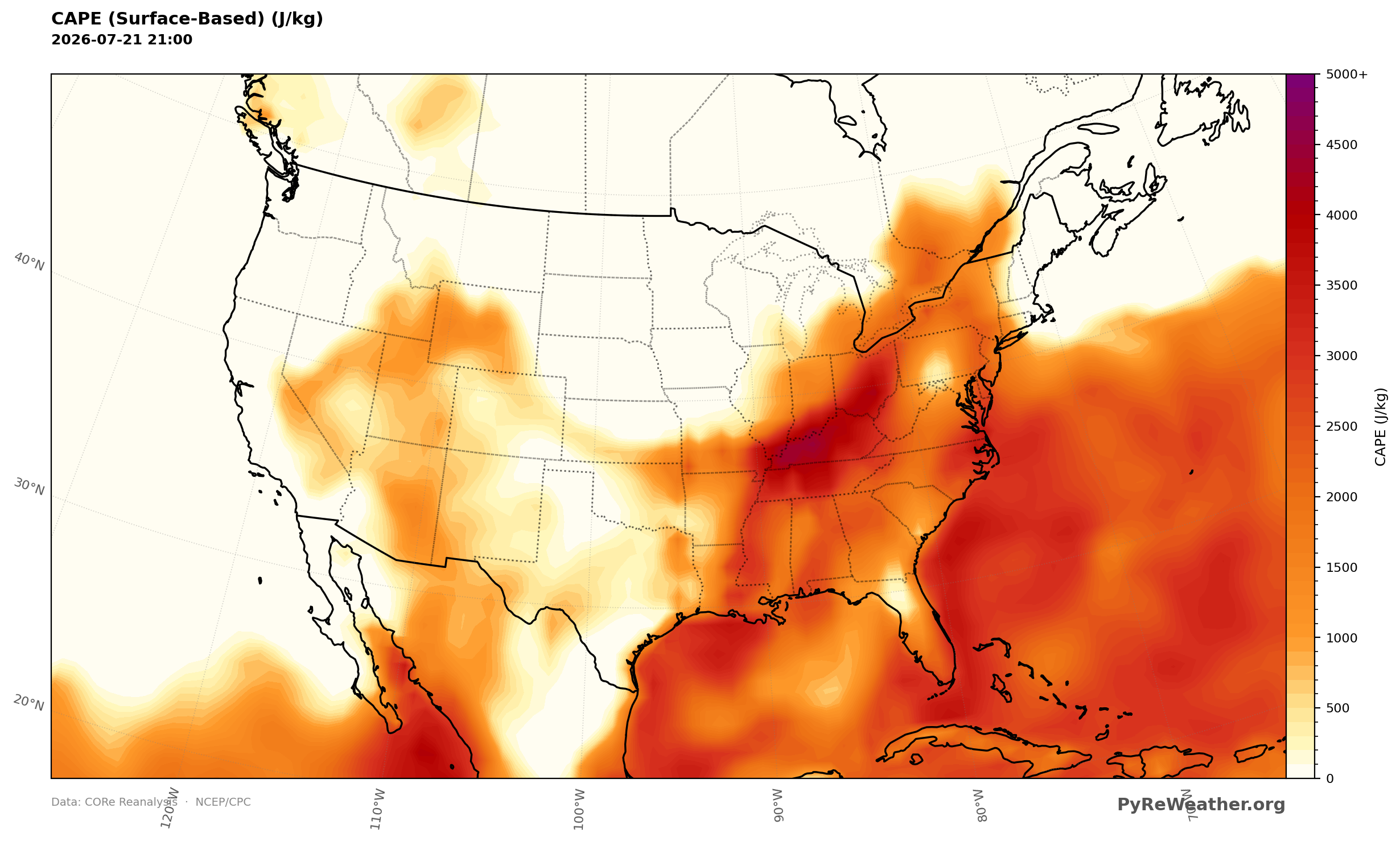
A ribbon of instability pooled ahead of the front from the Mid-South into the Northeast.
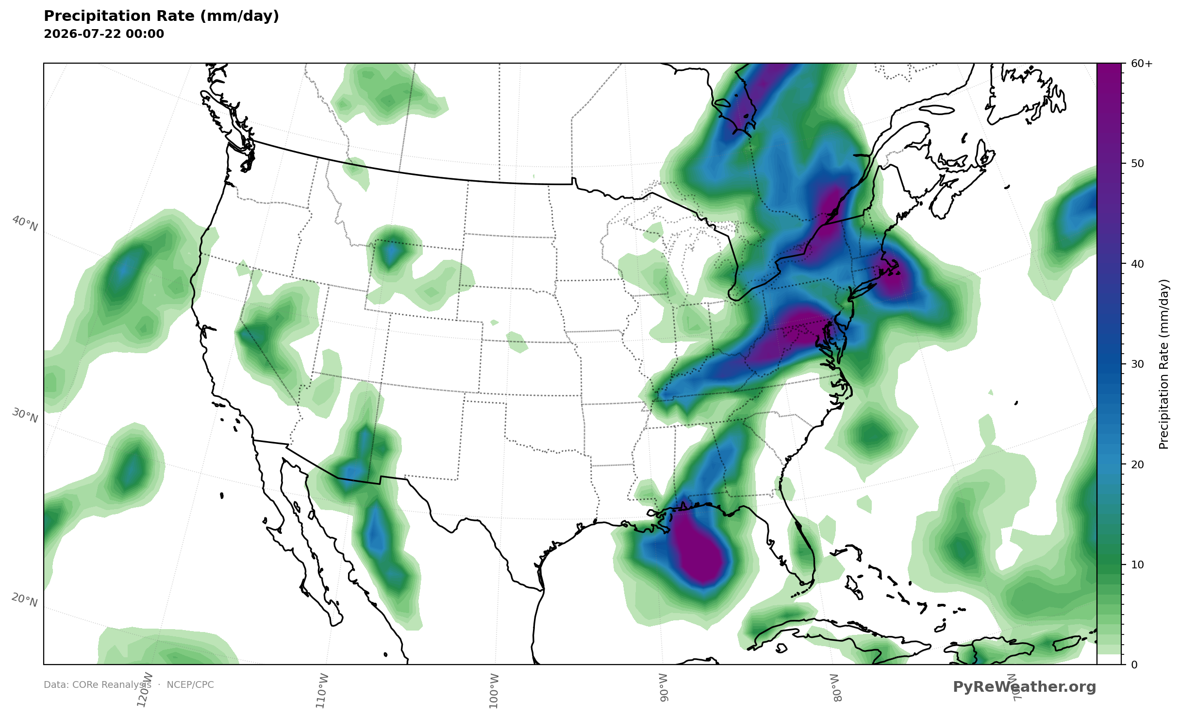
Rain rates spiked along the front in the East and over the central and southern Rockies.
Tropical Storm Bertha closing on the Gulf Coast
Across the northeast Gulf, Tropical Storm Bertha tracked west just south of the Florida Panhandle toward southeast Louisiana, dragging a deep column of tropical moisture with it. Most of the heaviest rain stayed offshore, south of the coastline, but the storm's outer bands still had enough moisture to touch off isolated to scattered flash flooding near the coast.
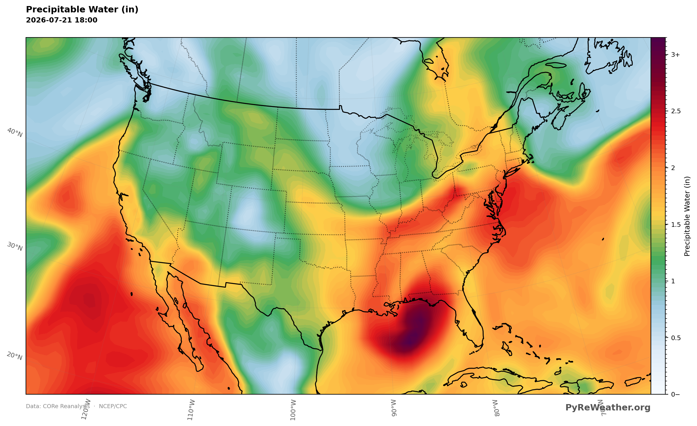
A deep plume of tropical moisture wrapped around Bertha near the northeast Gulf.
Monsoon thunderstorms over the Southwest
On the western side of the ridge, monsoonal moisture circulated up into the central and southern Rockies and set off scattered afternoon and evening thunderstorms. Storm motions stayed slow, so rain rates ran heavy over the higher terrain where the storms parked over the same slopes.
Hazardous heat across the Southern Plains and Southeast
Under the subtropical ridge, afternoon temperatures pushed into the upper 90s and 100s across the Southern Plains and Southeast, where heat indices reached 105 to 115 degrees. Overnight lows only sagged into the 75 to 80 degree range, giving little relief and raising the risk of heat-related illness for anyone without steady cooling or hydration.
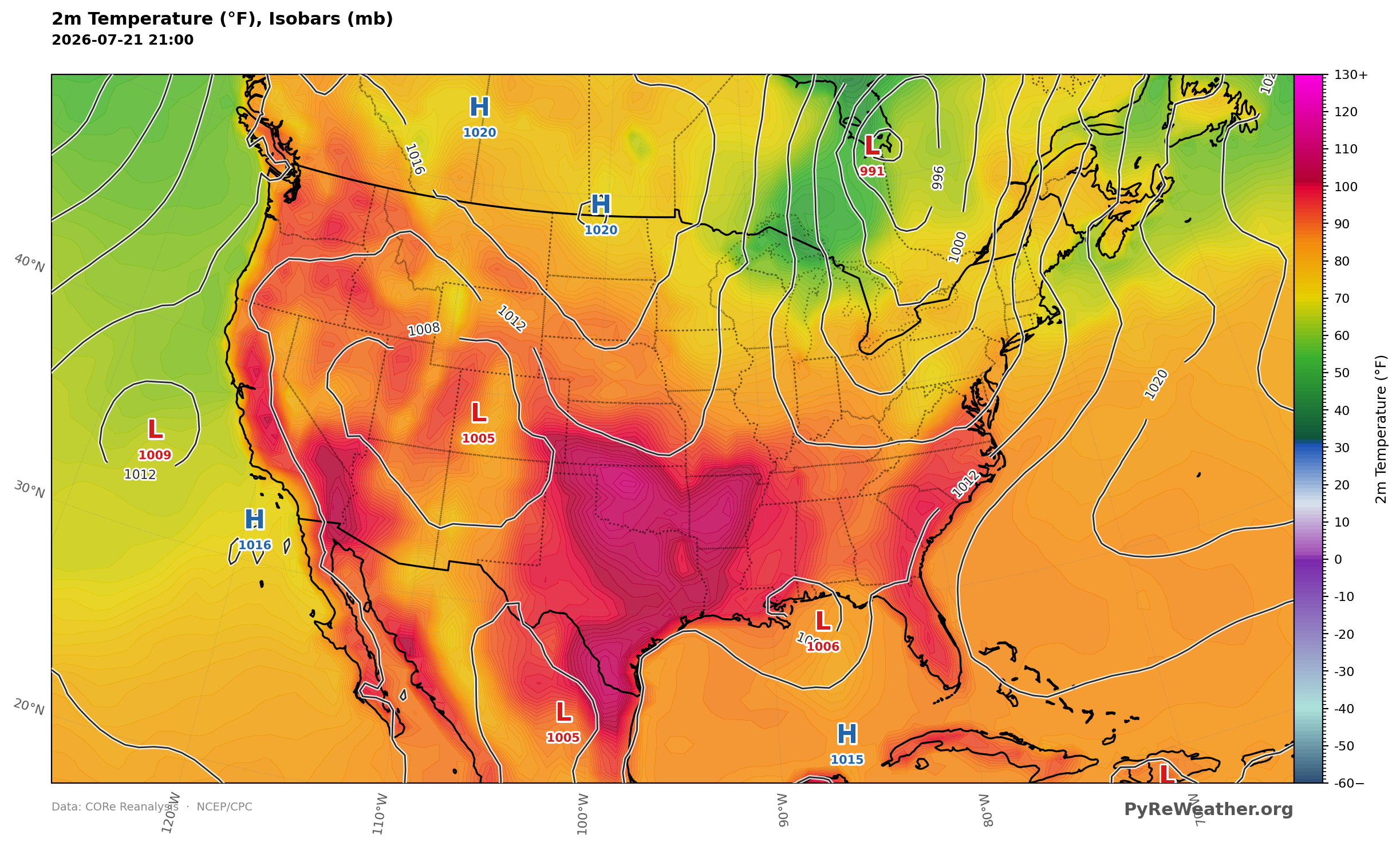
Afternoon readings climbed into the upper 90s and 100s across the Southern Plains and Southeast under the ridge.