
Persistent Heat Meets Western Cooling as Heavy Rain and Severe Storms Target the Ohio Valley
Summer heat holds from the Central Plains to the Southeast while a cooling trend arrives in the West, and thunderstorms bring heavy rain and severe weather to the Midwest and Ohio Valley.
A broad mid-level ridge over the Four Corners is expected to shift eastward toward the mid-Mississippi Valley over the next two days as shortwave troughing overtakes the West Coast. This pattern keeps hot weather in place from the Central Plains to the Southeast while a cooling trend develops across the West and Northern Plains. A meandering frontal boundary across the north-central U.S. remains the focus for thunderstorms and heavy rainfall, with the Ohio Valley a particular concern for flash flooding today.
Eastern Heat Beneath the Ridge
The mid-level ridge over the Four Corners will maintain hot weather from the Central Plains to the Southeast this week. High temperatures are expected to remain in the upper 90s and triple digits where widespread Heat Advisories are in effect, and a few high temperature records remain possible in the Central High Plains and Southeast.
Western Cooling and Southwest Rainfall
As shortwave troughing overtakes the West Coast, a cooling trend sets in across the West and Northern Plains. High temperatures are forecast to fall 10 to 20 degrees west of the Continental Divide by Thursday as a front begins to overtake the region and cloud and precipitation coverage increases. Some showers and thunderstorms will pose a threat for heavy rainfall and flash flooding, especially across southern Arizona, where a Slight Risk of flash flooding is anticipated over the next couple of days.
Ohio Valley Flash Flooding and Severe Storms
A frontal boundary meandering across the north-central U.S. keeps the focus for thunderstorms and heavy rainfall across the Midwest, lower Great Lakes, and Ohio Valley. Today there is particular concern for impactful flash flooding in the Ohio Valley, where another 2 to 4 inches of rain may fall near an area already inundated by the previous day's flash flooding. An active day for severe weather is also anticipated across northern Illinois and the Ohio Valley, primarily for damaging wind gusts. The heavy rain threat will continue Wednesday along this corridor, though severe storm chances should be less prominent.
Northern High Plains Storm Chances
Over the Northern High Plains, daily chances of scattered severe weather and isolated heavy rainfall will remain in the vicinity of a stationary front and weak low pressure wave, with a hail threat over the next couple of days.
Atmospheric Setup Maps for August 11, 2026
500mb Geopotential Height, 12Z August 11, 2026
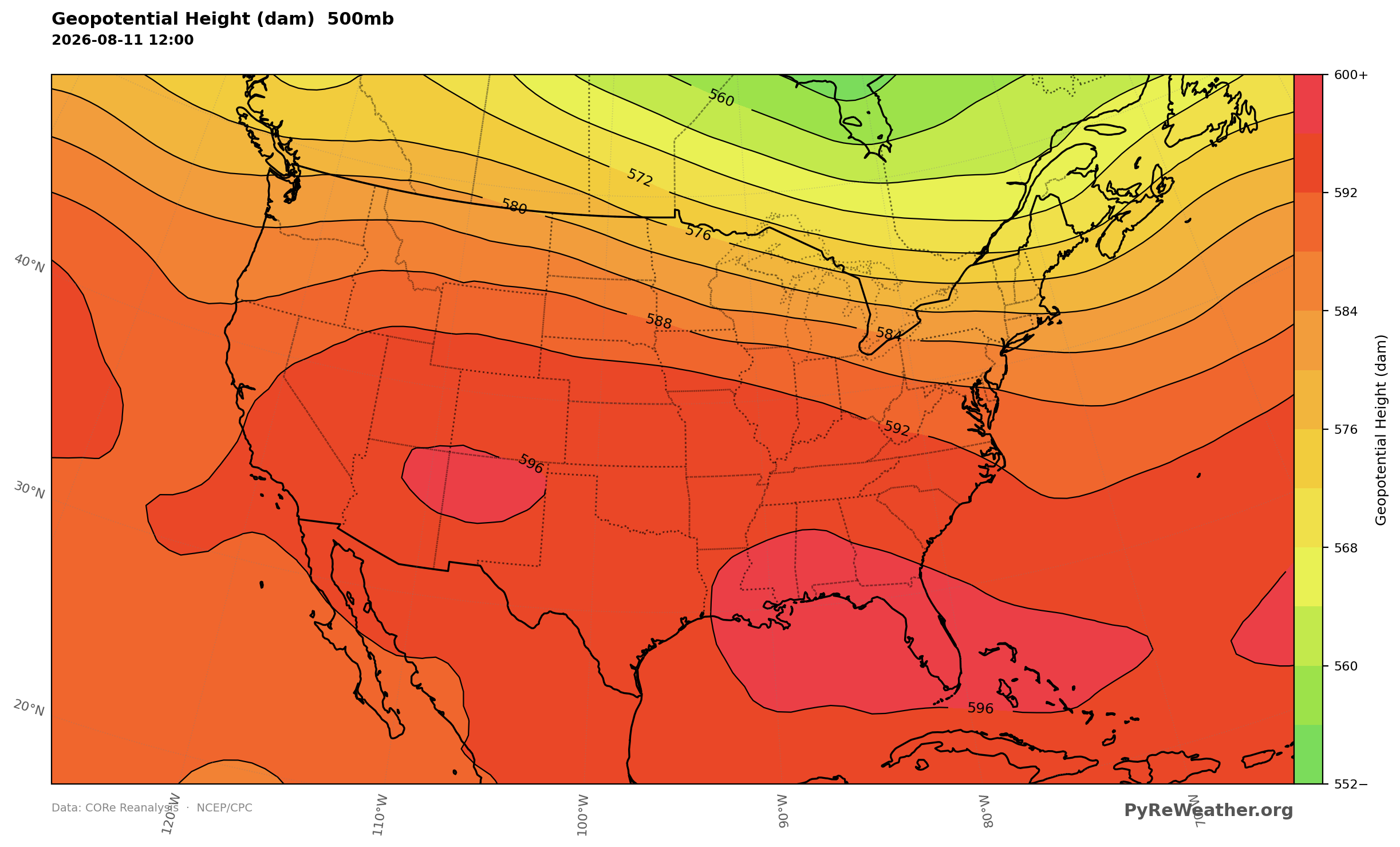
500mb heights show the mid-level ridge centered near the Four Corners and forecast to migrate eastward toward the mid-Mississippi Valley, supporting continued heat across the Central Plains to the Southeast.
500mb Absolute Vorticity, 18Z August 11, 2026
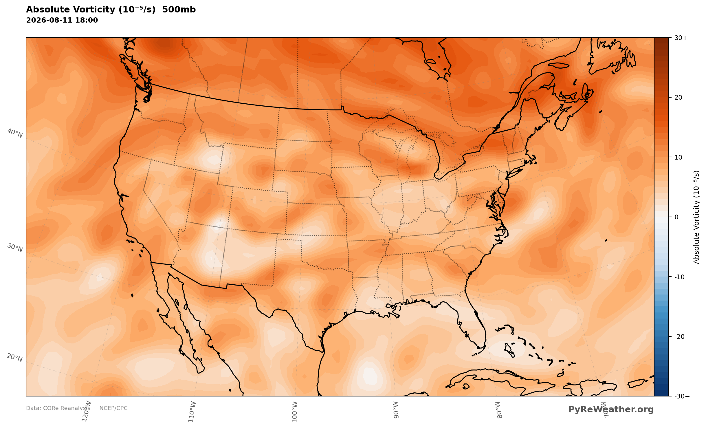
500mb vorticity highlights the shortwave troughing overtaking the West Coast that helps drive the western cooling trend and increasing precipitation.
300mb Wind Speed, August 11, 2026 18Z
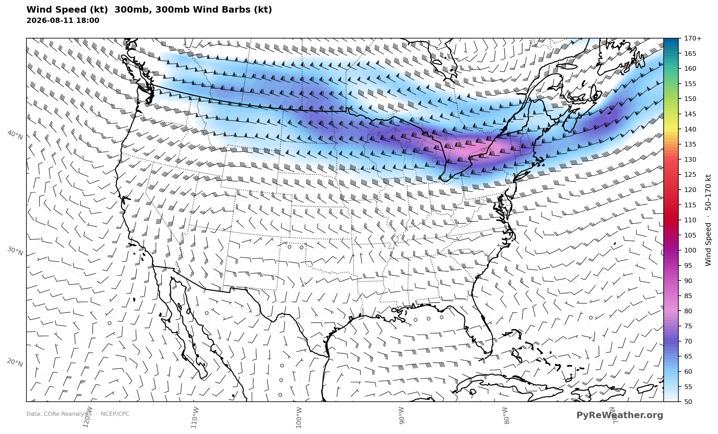
300mb winds outline the upper-flow pattern separating the eastern ridge from the approaching western trough over the next two days.
850mb Wind Speed on August 11, 2026 18Z
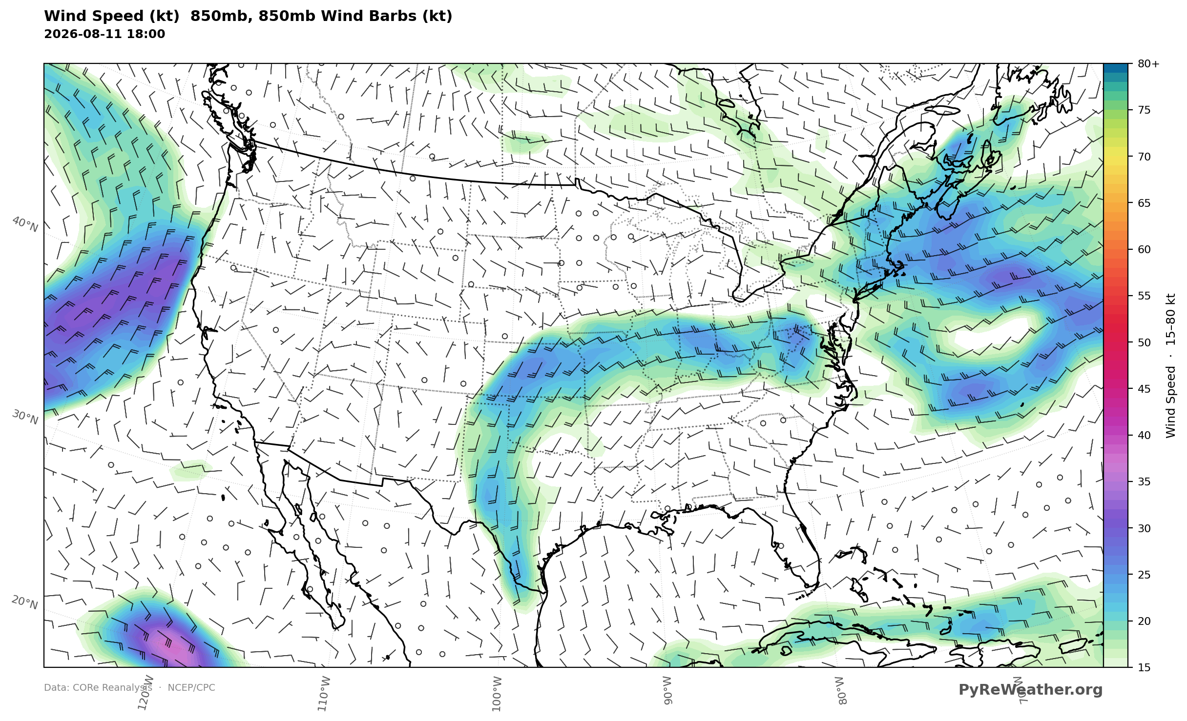
850mb winds depict the low-level flow near the frontal boundary meandering across the north-central U.S. that focuses thunderstorms over the Midwest, lower Great Lakes, and Ohio Valley.
Mean Sea Level Pressure August 11, 2026 18Z
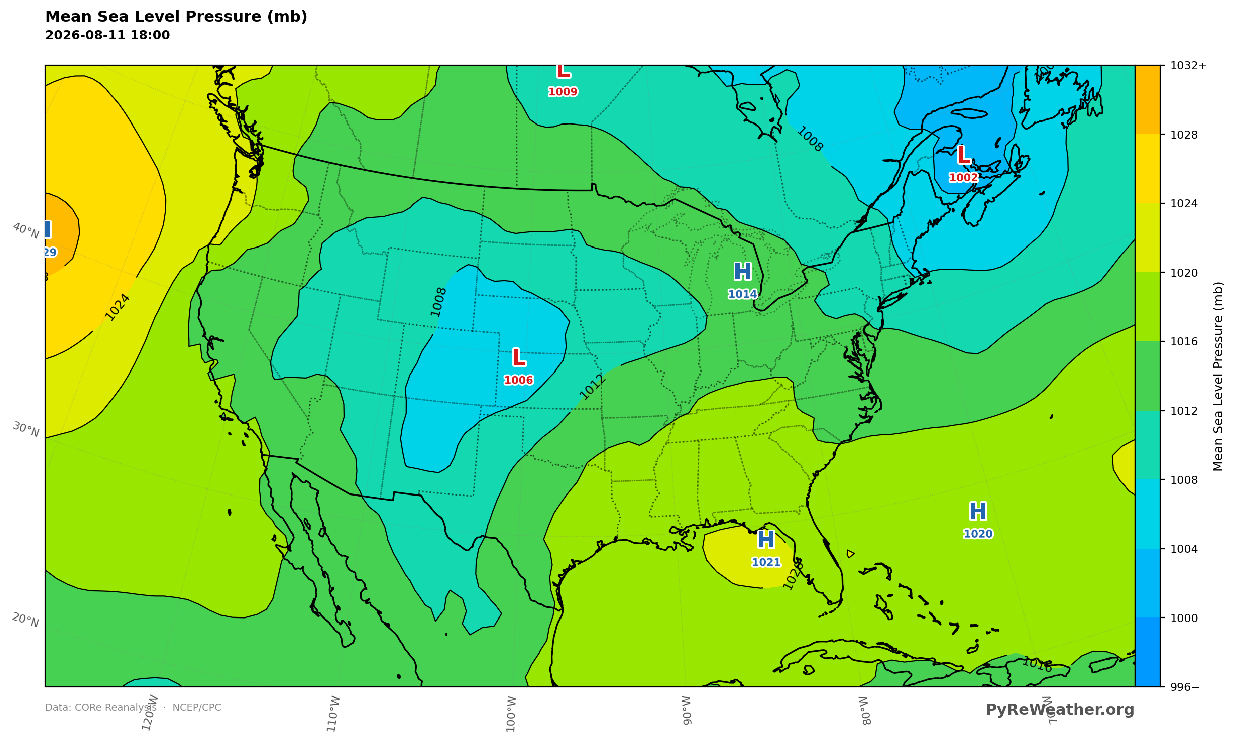
MSLP places lower pressure over the Northeast and central High Plains and higher pressure near the Southeast, supporting return flow into the Plains.
2m Temperature Anomaly, August 11, 2026 21Z
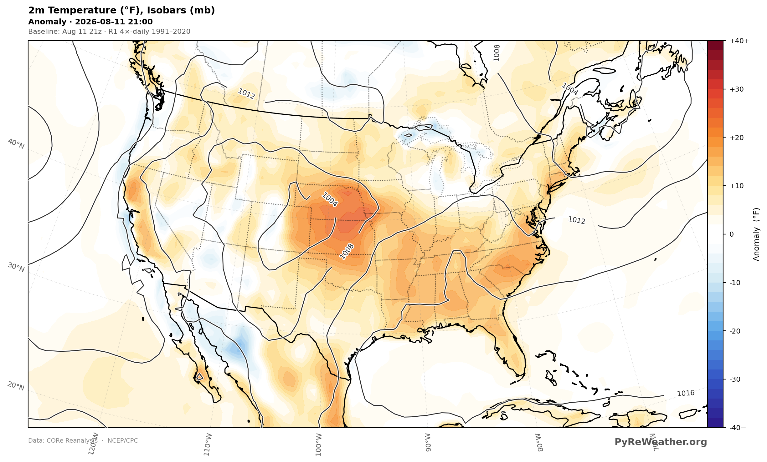
Surface temperature anomalies show the persistent heat from the Central Plains to the Southeast, where readings stay in the upper 90s and triple digits.
Surface CAPE, August 11, 2026 21Z
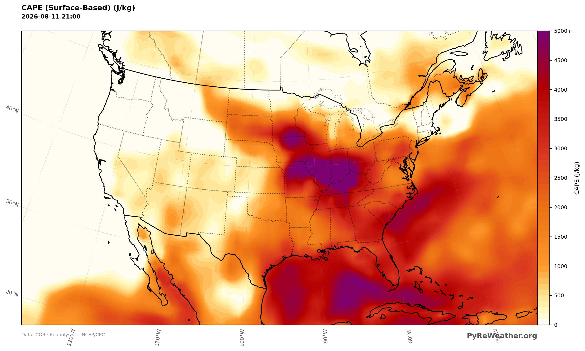
Surface CAPE highlights the instability supporting severe thunderstorms across northern Illinois and the Ohio Valley today.
Source: NWS WPC Short Range Forecast Discussion, issued 344 AM EDT Tue Aug 11 2026