
Texas Hill Country flooding while heat and Canadian smoke settle over the north
An upper low fed heavy rain into central Texas while a stubborn upper high held triple-digit heat across the northern states and cooler winds dragged Canadian wildfire smoke into the Northeast.
A slow, split pattern held the country on July 16, 2026. An upper-level low over the southern High Plains wrung heavy rain out of central Texas, a strong upper high baked the Northern Plains, Great Lakes, and northern Mid-Atlantic, and westerly winds behind a cold front pulled Canadian wildfire smoke into the Northeast. Monsoon storms rolled south across the Four Corners.
A stalled pattern from Texas to the Great Lakes
The day's weather hung on two features that refused to move. A strong upper high sat over the northern tier, its ridge arcing across the Northern Plains and Great Lakes, while a closed upper low had drifted west into the southern High Plains. Between them a front lay stationary across the southern states, and that boundary was where the rain kept firing. The low over the High Plains steered thunderstorm clusters northward through Texas, and the ridge to the north locked in the heat that had built beneath it.
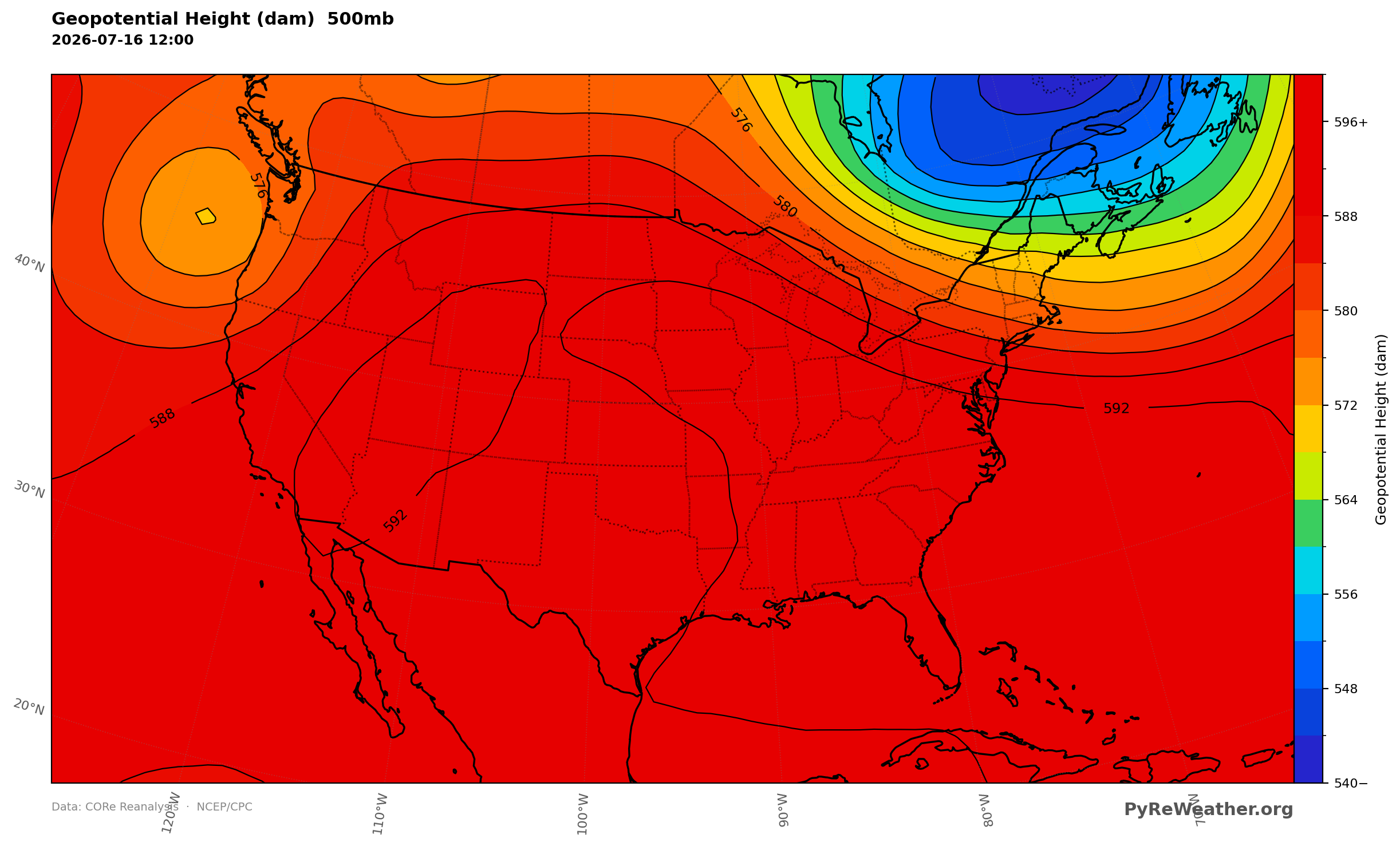
A ridge anchored over the northern states with a closed low spinning over the southern High Plains.
Flooding rains in the Texas Hill Country and Monsoon storms across the Four Corners
The upper low pulled a deep ribbon of Gulf moisture straight into Texas, and where that moisture met the front, storms trained over the same ground for hours. Heavy thunderstorm clusters tracked from the Hill Country northward into central Texas, dropping rainfall totals in the range of 6 to 8 inches with locally more than 10 inches, worsening flash flooding already underway. The moisture plume over the state ran far wetter than the air on either side, which is why the rain stayed concentrated rather than spreading out.
Well to the west, the upper low over the southern High Plains also drove the monsoon. Showers and thunderstorms tracked from north to south across the Four Corners, with the greatest flash flooding threat hugging the southern borders of Arizona and New Mexico. More storms bubbled up across the Intermountain West and the eastern Great Basin, while on the far end of the front a low-pressure wave set off severe thunderstorms over western Montana.
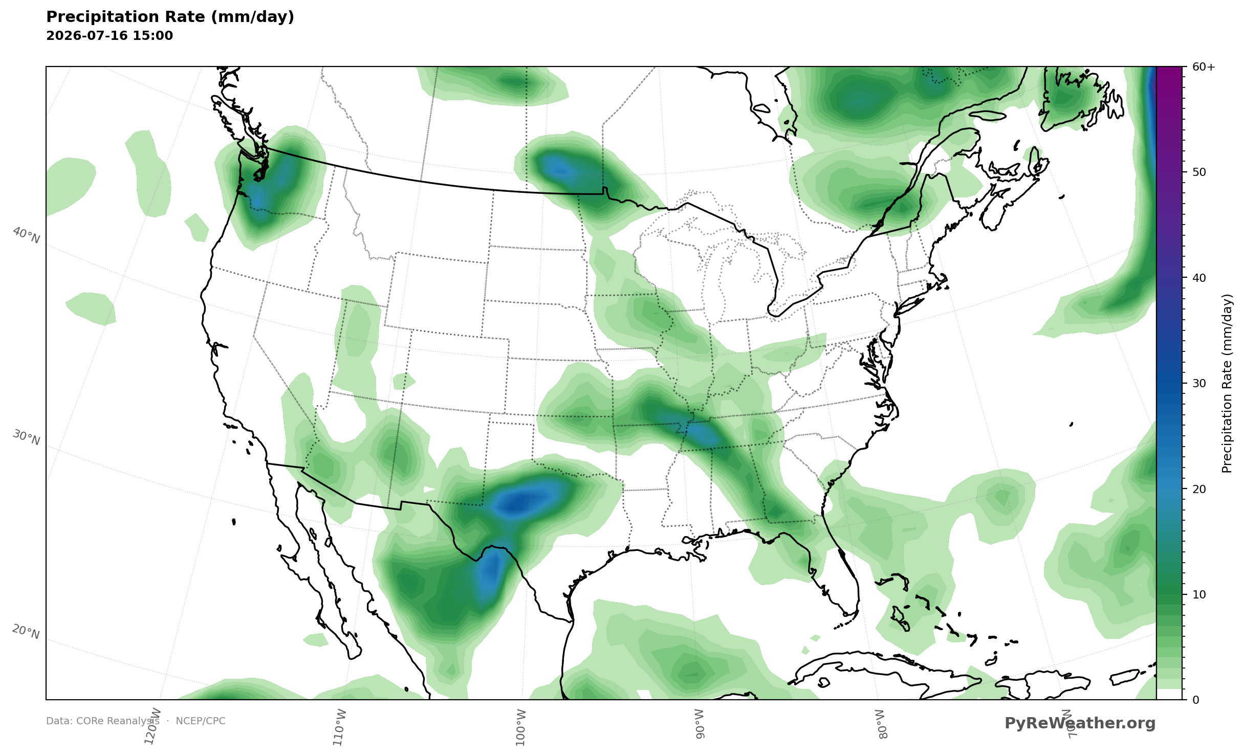
Heaviest rates ran from the Texas Hill Country northward into central Texas, with a second area over the Four Corners.
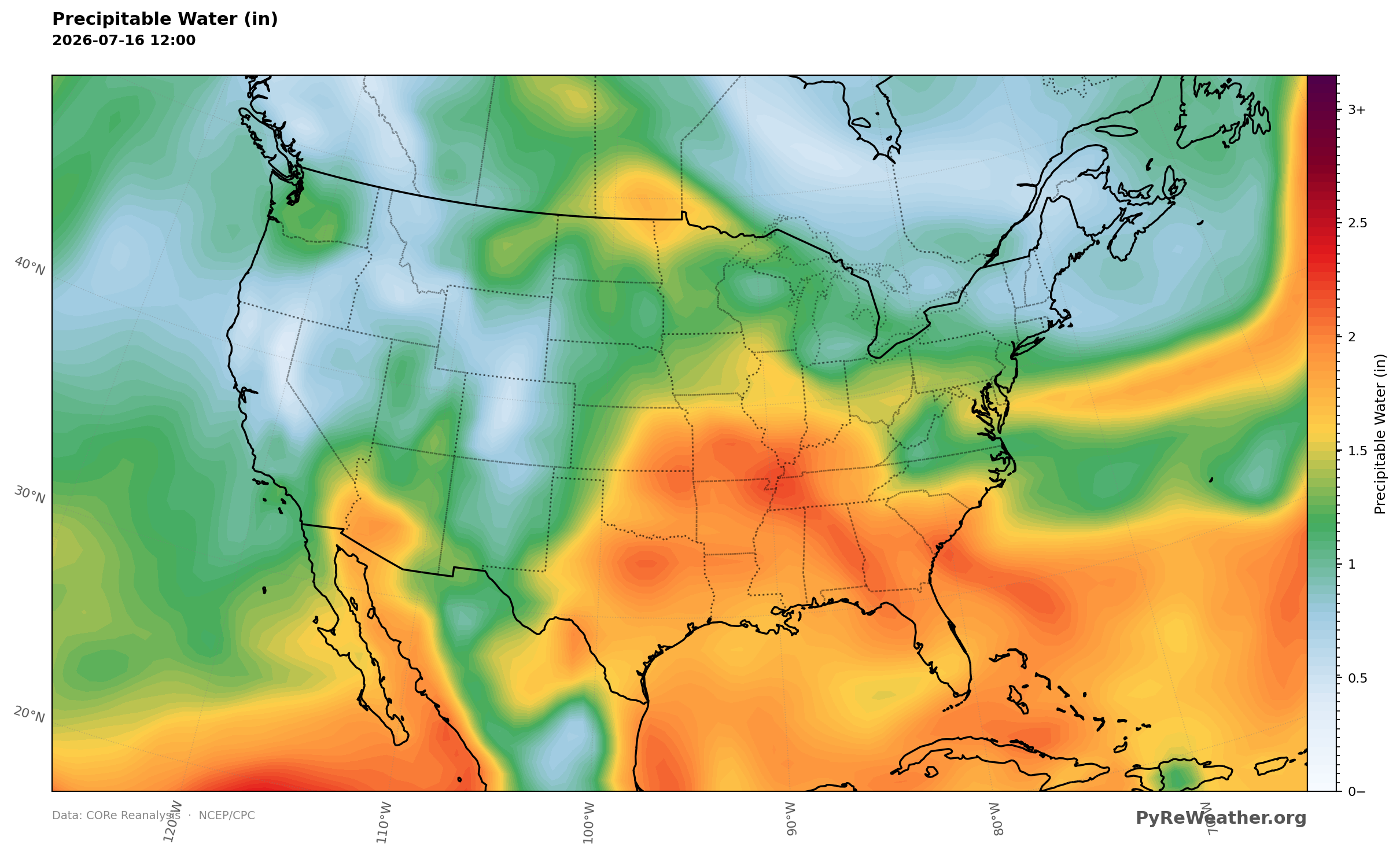
A deep plume of moisture streamed off the Gulf into Texas, feeding the storms.
Heat and humidity from the Northern Plains to the Mid-Atlantic
Under the ridge, afternoon highs held steady in the 90s to lower 100s across the Northern Plains, Upper Midwest, and Great Lakes, and the same muggy air pushed east into the northern Mid-Atlantic, where readings again reached the triple digits. A cold front slipped into New England behind gusty westerly winds, cooling the region, with a second front lined up to reinforce that cooler air the next morning. Ahead of it, strong thunderstorms were possible across northern New England.
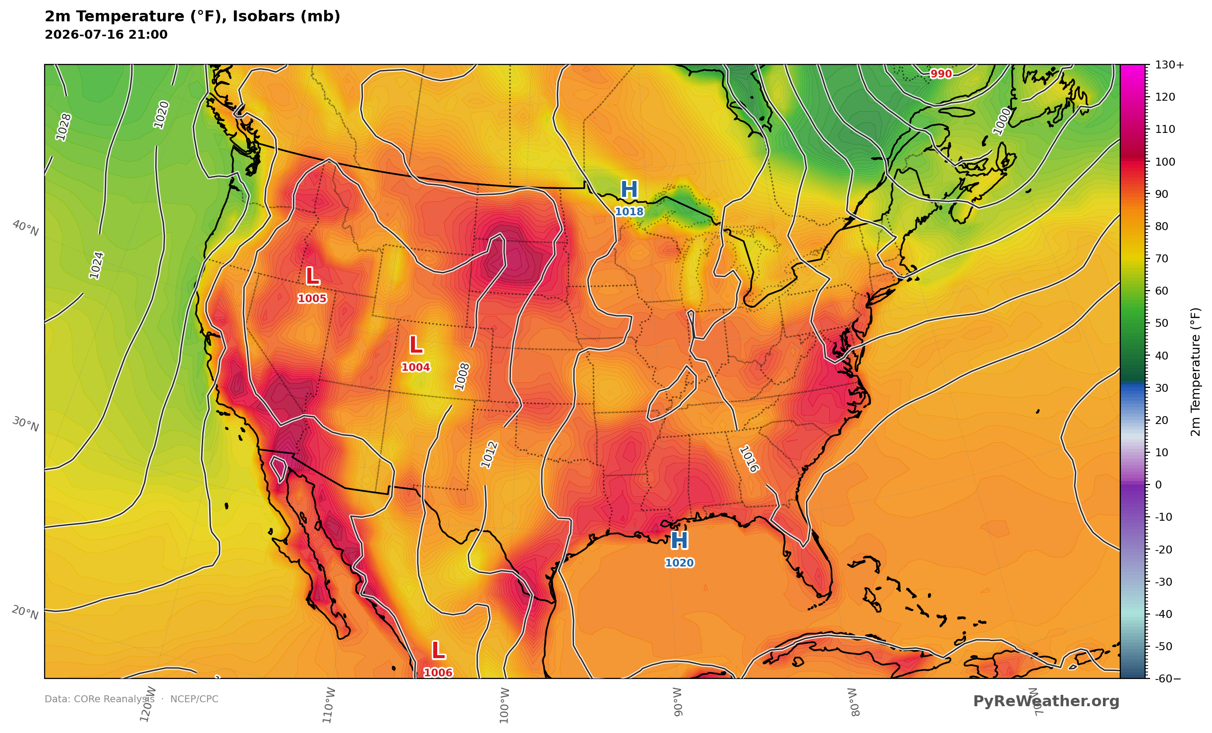
Afternoon readings held in the 90s to low 100s from the Northern Plains through the Great Lakes into the northern Mid-Atlantic.
Canadian wildfire smoke in the Northeast
The cooler air arriving behind the cold front came with a catch. Westerly winds at 700mb blew across the Great Lakes and into the Northeast, and that same flow carried smoke from Canadian wildfires into the northeastern quarter of the country. Air quality alerts stretched from the Upper Midwest through the Great Lakes into the Northeast.
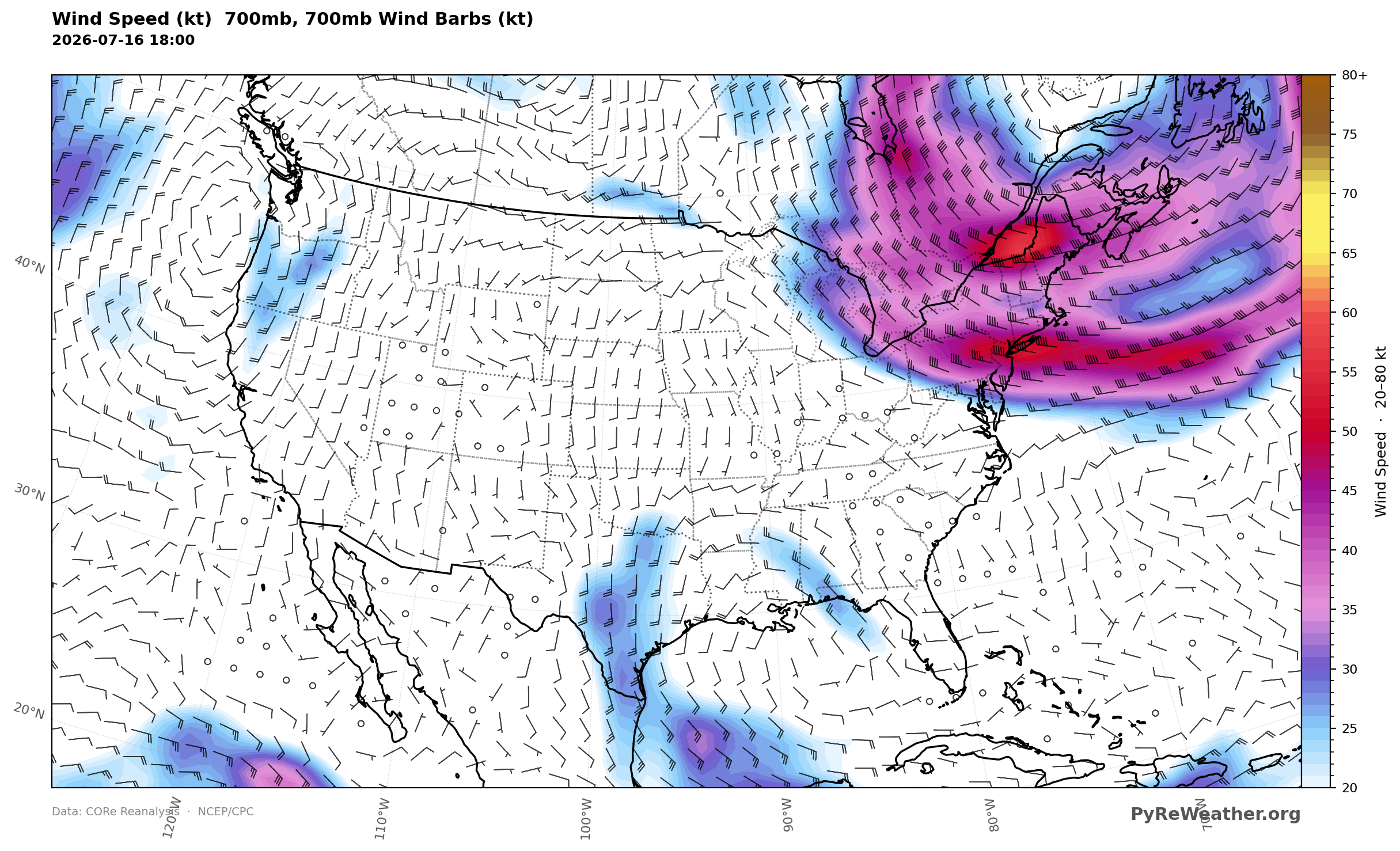
Westerly flow at 700mb pushed across the Great Lakes into the Northeast, the path the smoke rode.