
Northern Tier storms, Southwest monsoon, and Great Lakes smoke
A front swept storms through the Northeast and Ohio Valley while monsoon rains soaked the Four Corners and smoke fouled the Great Lakes.
An amplifying trough pivoting across the Upper Great Lakes pushed a front through the Northeast and Ohio Valley, firing showers and thunderstorms, while a retrograding upper low over west Texas fed monsoon storms across the Four Corners. Smoke poured into the Upper Midwest on northwest winds, and heat began building beneath a ridge over the Central U.S.
Trough and ridge split the country
The day's weather divided along a clear line in the upper atmosphere. An amplifying trough dug across the Upper Great Lakes, sending a frontal system through the Northeast and Ohio Valley, while a broad ridge bulged over the Central U.S. and set the stage for building heat. Far to the south, a stubborn upper low sat over west Texas and slowly retrograded toward the Desert Southwest, keeping the Southern Tier in a slow-moving, wet pattern.
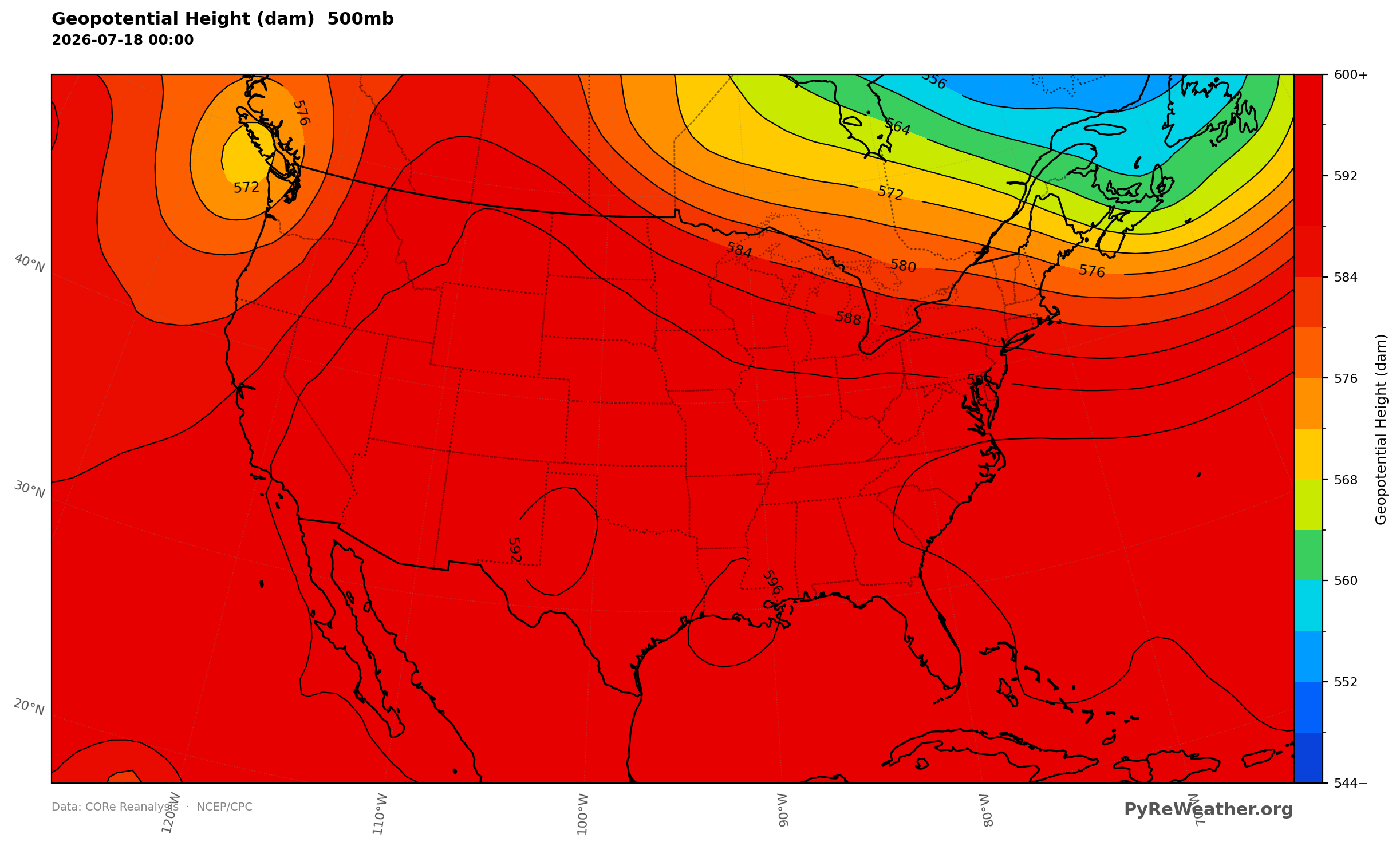
A trough dug across the Upper Great Lakes while a broad ridge bulged over the center of the country.
Storms across the Northeast and Ohio Valley
A moist, unstable airmass surged northward ahead of the front, and where it met the boundary the day's storms lined up from the Ohio Valley into the Northeast. Showers and thunderstorms capable of widely scattered severe weather and flash flooding broke out through the morning and afternoon. To the south, a disturbance near the Florida Panhandle brought unsettled weather to the eastern Gulf Coast, with isolated flash flooding possible.
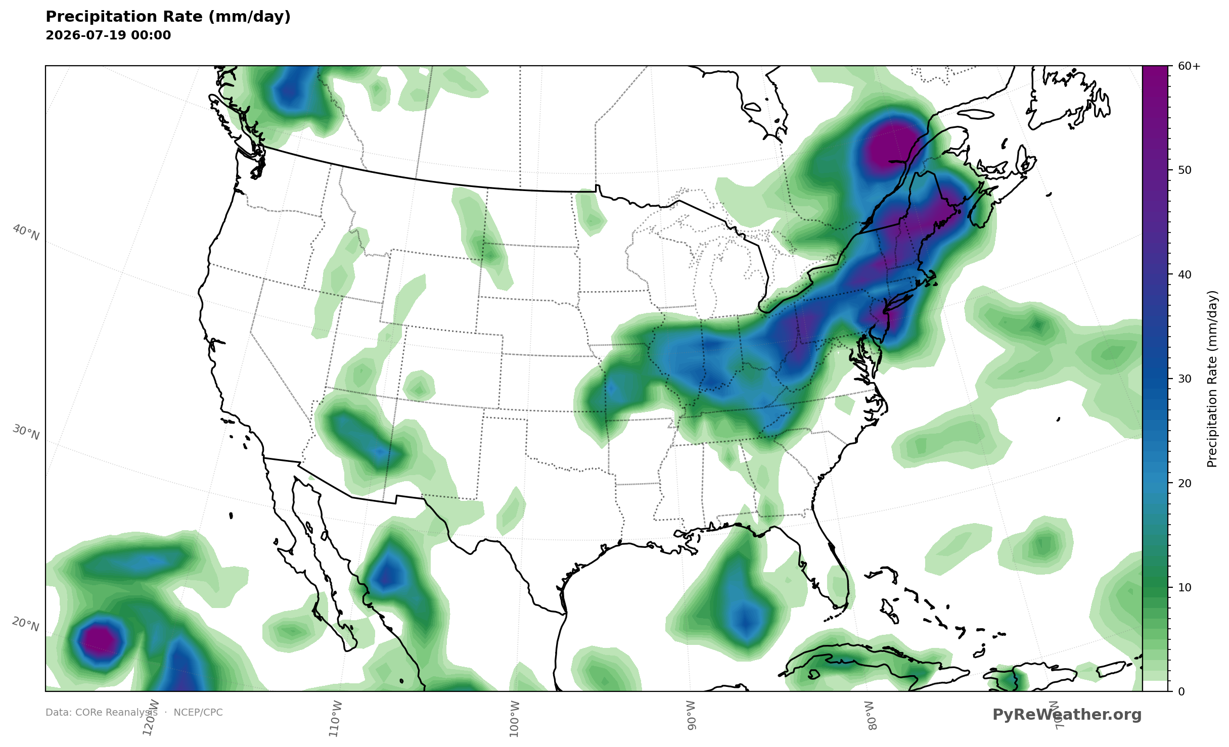
Rain lined up from the Ohio Valley into the Northeast and clustered over the Four Corners and the eastern Gulf Coast.
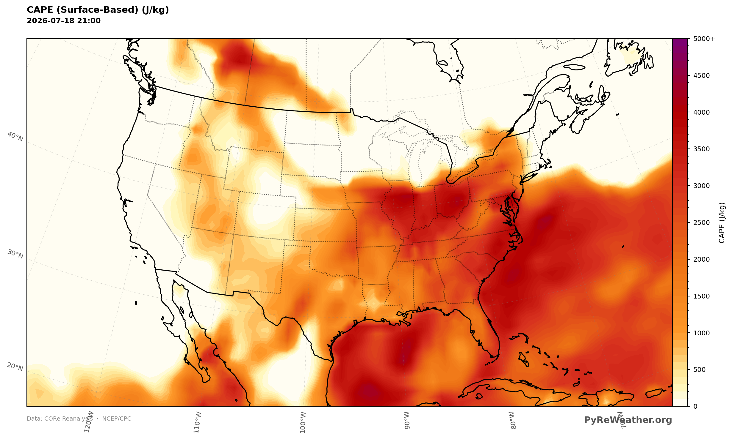
A moist, unstable airmass surged north ahead of the front across the Ohio Valley and Northeast.
Monsoon rains over the Four Corners
The retrograding upper low over west Texas juiced monsoonal thunderstorms across the Four Corners and Desert Southwest. With soils already sensitive from recent rain, the storms brought a threat of widely scattered flash flooding as they trained over the same ground day after day.
Smoke in the Great Lakes and Upper Midwest
The same front that cleared smoke out of the Northeast and Mid-Atlantic left the Upper Midwest and Great Lakes stuck with poor air quality. Northwesterly flow ushered in another smoke plume from Ontario, and air quality alerts stretched from the Upper Midwest into New England as the haze settled in.
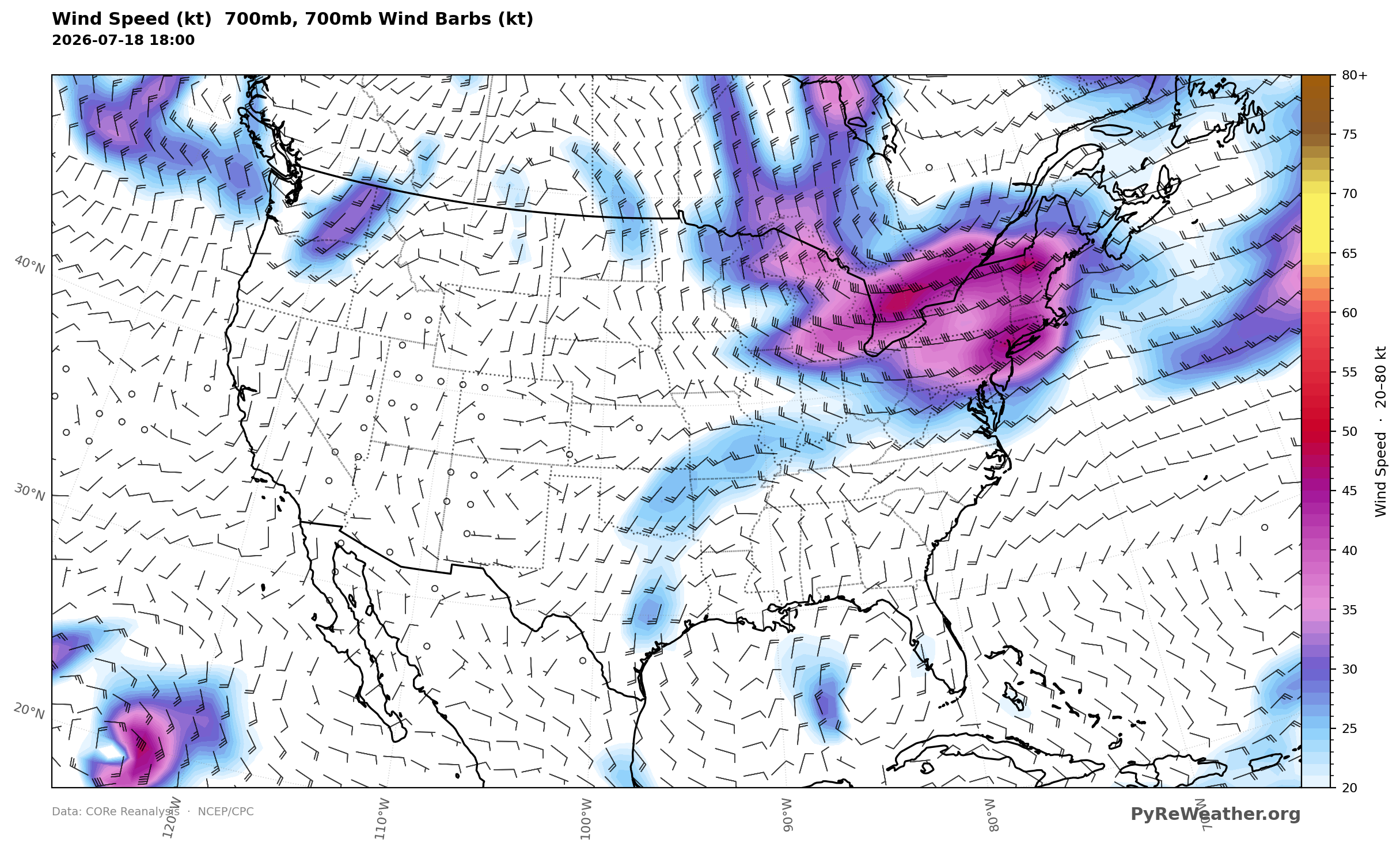
Northwesterly flow at 700mb steered a smoke plume out of Ontario into the Upper Midwest and Great Lakes.
Heat building over the Central U.S.
Beneath the ridge, hot and humid air spread from the Northern Plains into the Lower Mississippi Valley to close out the weekend. Heat Advisories went up across the Central U.S., where heat index readings could top 110 degrees in spots.
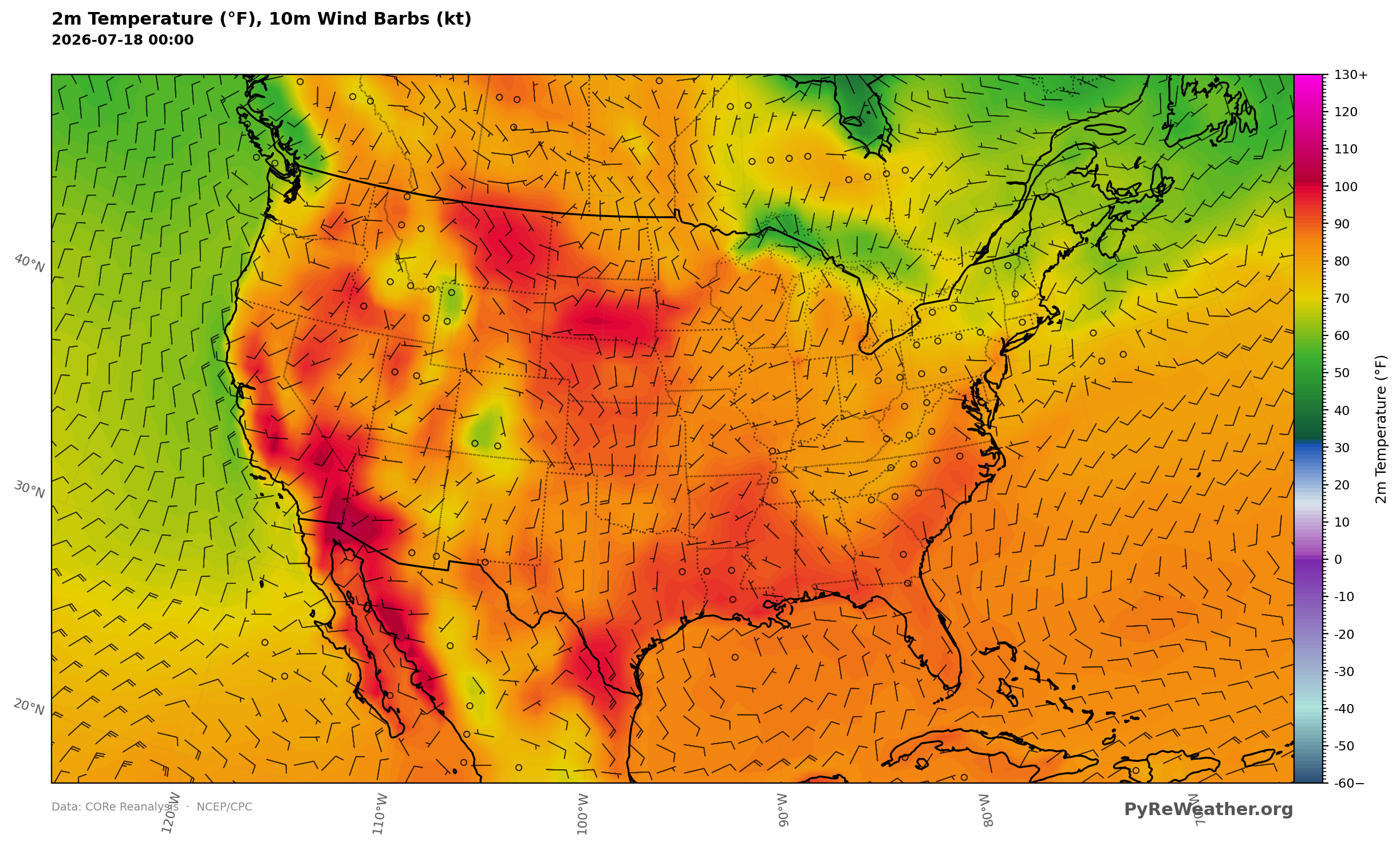
Hot air spread from the Northern Plains into the Lower Mississippi Valley under the ridge.