
Strengthening Frontal System Fuels Plains Storms as Dangerous Heat Grips the South-Central U.S.
A deepening frontal system will spread showers and thunderstorms from the Intermountain West to the Plains while dangerous heat persists across the south-central U.S. through midweek.
As calm high pressure settles over the East, attention shifts to the Western and Central U.S. ahead of a strengthening frontal system forecast to lift out of the Rockies today. Strengthening southerly flow ahead of this deep system will draw a very moist airmass northward into the Heartland, setting the stage for widespread showers and thunderstorms beginning this morning ahead of a trailing cold front.
Plains Storms and Flash Flood Threat
A strengthening frontal system is forecast to lift out of the Rockies today, with strengthening southerly flow ahead of it drawing a very moist airmass northward into the Heartland. This will set the stage for widespread showers and thunderstorms beginning this morning ahead of a trailing cold front. Numerous instances of flash flooding and scattered severe weather are a concern later today over portions of the Central Plains as multiple rounds of thunderstorms develop in this very moist and unstable environment. While the cold front is forecast to slowly sink southward, persistent southerly inflow into the boundary will keep unsettled weather lingering across the Plains, enhancing the flash flood threat through midweek.
Southern Rockies and Four Corners Thunderstorms
Coverage of afternoon showers and thunderstorms will also increase over the Southern Rockies and Four Corners this week, supporting daily chances of scattered flash flooding.
Dangerous Heat in the South-Central U.S.
An upper-level ridge moving across the Mid and Lower Mississippi Valley will maintain dangerously hot weather, with highs well into the 90s and low 100s this week that could set several daily high temperature records. Combined with little relief at night, several days of Major to Extreme HeatRisk are likely, which would increase the likelihood of heat-related illnesses.
Atmospheric Setup Maps for September 14, 2026
500mb Geopotential Height, 9/14/2026 12Z
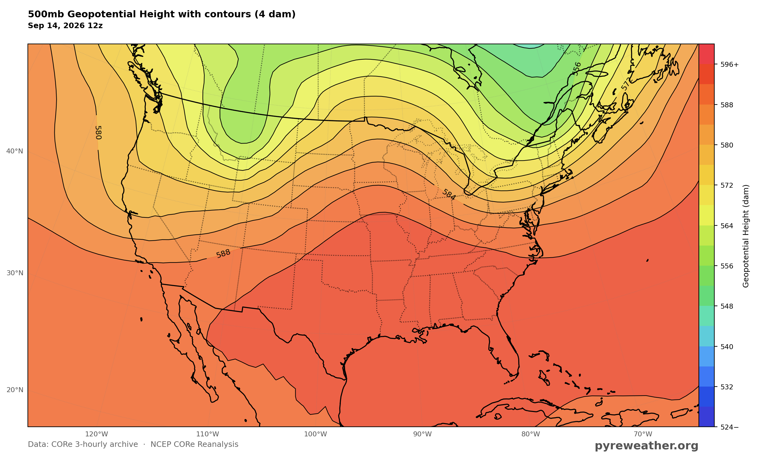
500mb heights show the upper ridge over the Mid and Lower Mississippi Valley and the deep system over the West that supports the strengthening frontal system.
500mb Absolute Vorticity, 9/14/2026 18Z
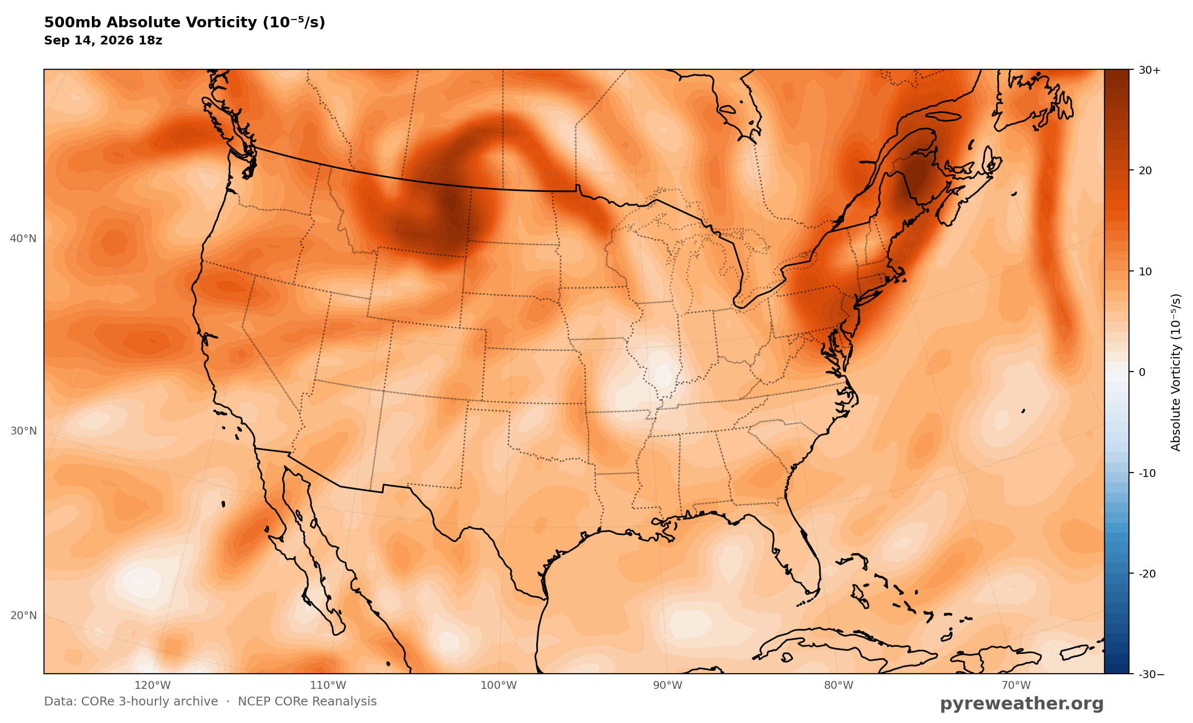
500mb vorticity highlights the disturbance associated with the frontal system lifting out of the Rockies.
300mb Wind Speed, 9/14/2026 18Z
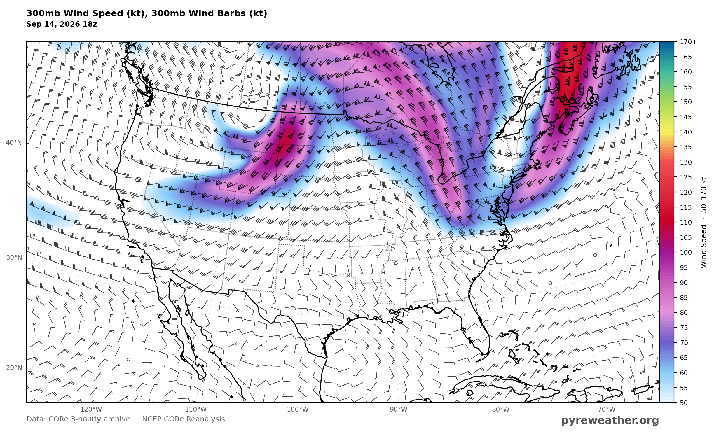
300mb winds mark the upper flow steering the deep system and strengthening southerly flow ahead of it.
850mb Wind Speed, 9/14/2026 18Z
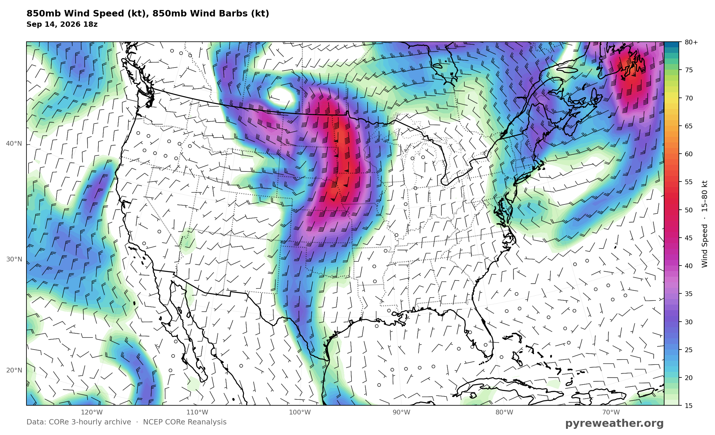
850mb winds show the strengthening southerly inflow drawing a very moist airmass northward into the Heartland.
Mean Sea Level Pressure, 9/14/2026 18Z
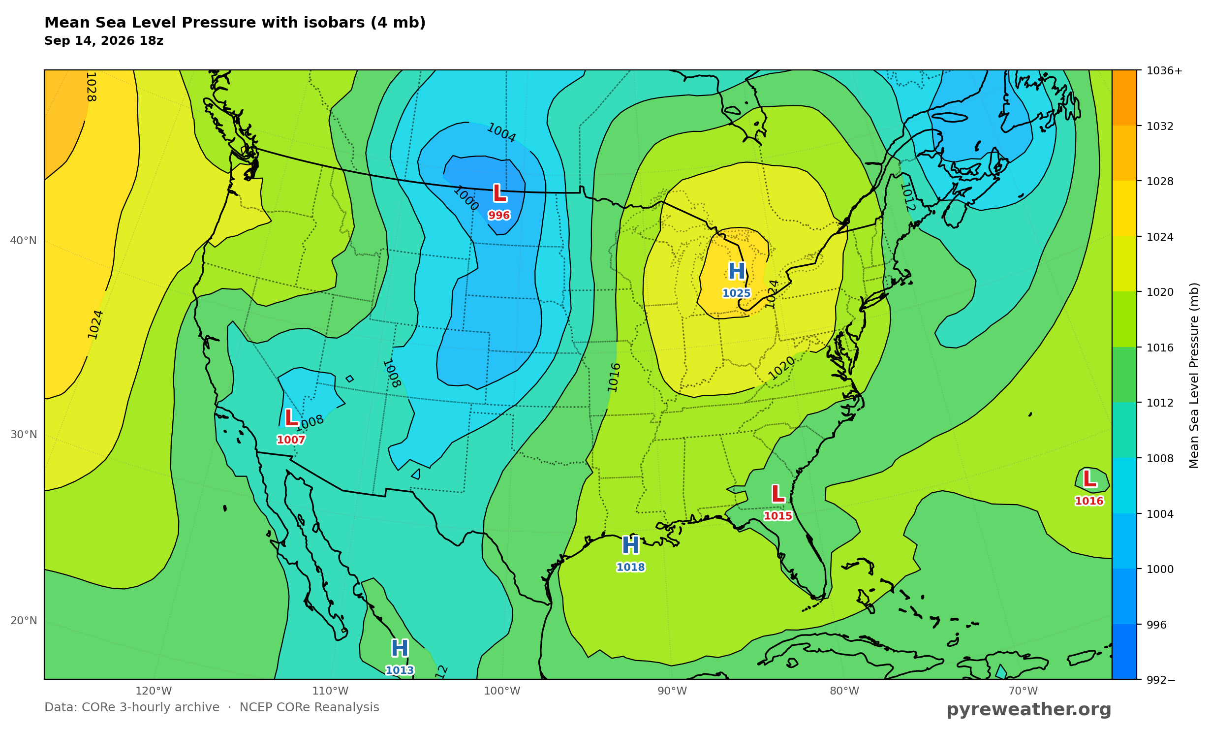
MSLP places lower pressure over the northern High Plains and Southwest and higher pressure near the Great Lakes and Gulf Coast, supporting return flow into the Plains.
2m Temperature Anomaly, 9/14/2026 21Z
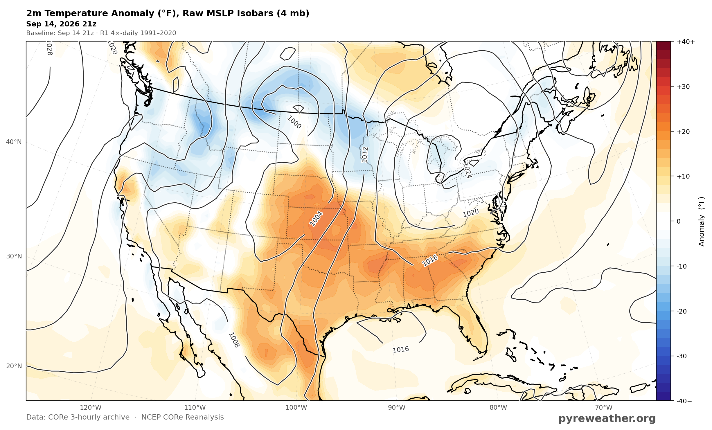
Surface temperature anomaly highlights the dangerously hot airmass under the upper ridge across the Mid and Lower Mississippi Valley.
Surface CAPE, 9/14/2026 21Z
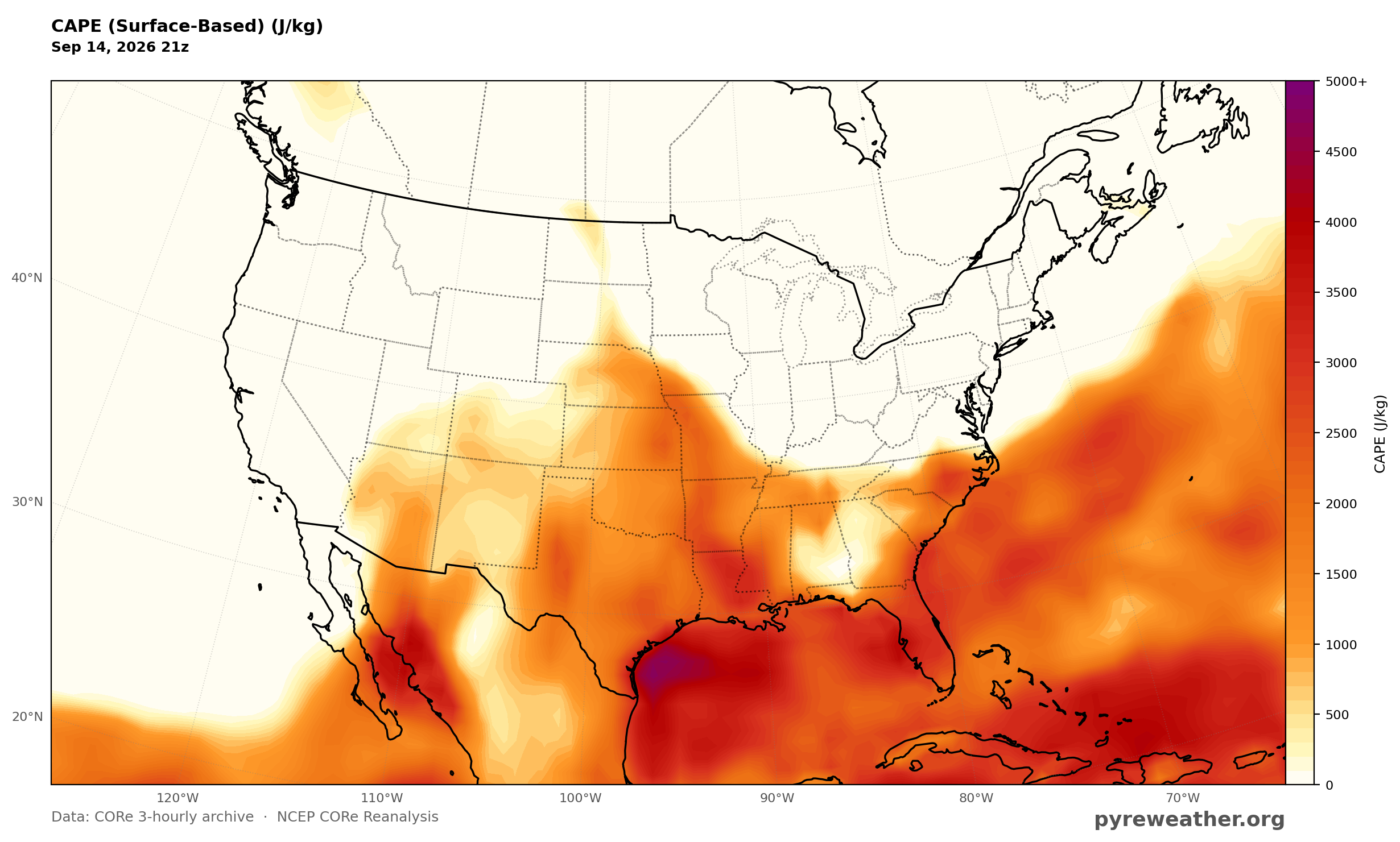
Surface CAPE shows the moist, unstable environment over the Central Plains supporting afternoon thunderstorm development.
Source: NWS WPC Short Range Forecast Discussion, issued 359 AM EDT Mon Sep 14 2026