
Helene Drives Flooding Rains into the Southern Appalachians
Helene pushed inland toward the Ohio Valley, dumping dangerous rain on the Southern Appalachians while heat gripped the desert Southwest.
Helene, weakening as it moved northwestward toward the Ohio Valley, wrung out heavy rain across the Southern Appalachians and spun up severe storms over the southern Mid-Atlantic. Far to the west, an upper-level high kept the desert Southwest baking under Excessive Heat Warnings.
Helene tracking toward the Ohio Valley
Helene held together as it churned inland, its low center over the Southeast and aimed at the Ohio Valley by Saturday. At 500mb the storm showed up as a closed low pinned beneath a broad ridge that stretched across the Southwest, and that same ridge kept Helene from racing away — it crawled and weakened slowly, which meant hour after hour of rain over the same ground. The surface map put the closed low right over the Southeast, its circulation feeding moisture northward into the mountains.
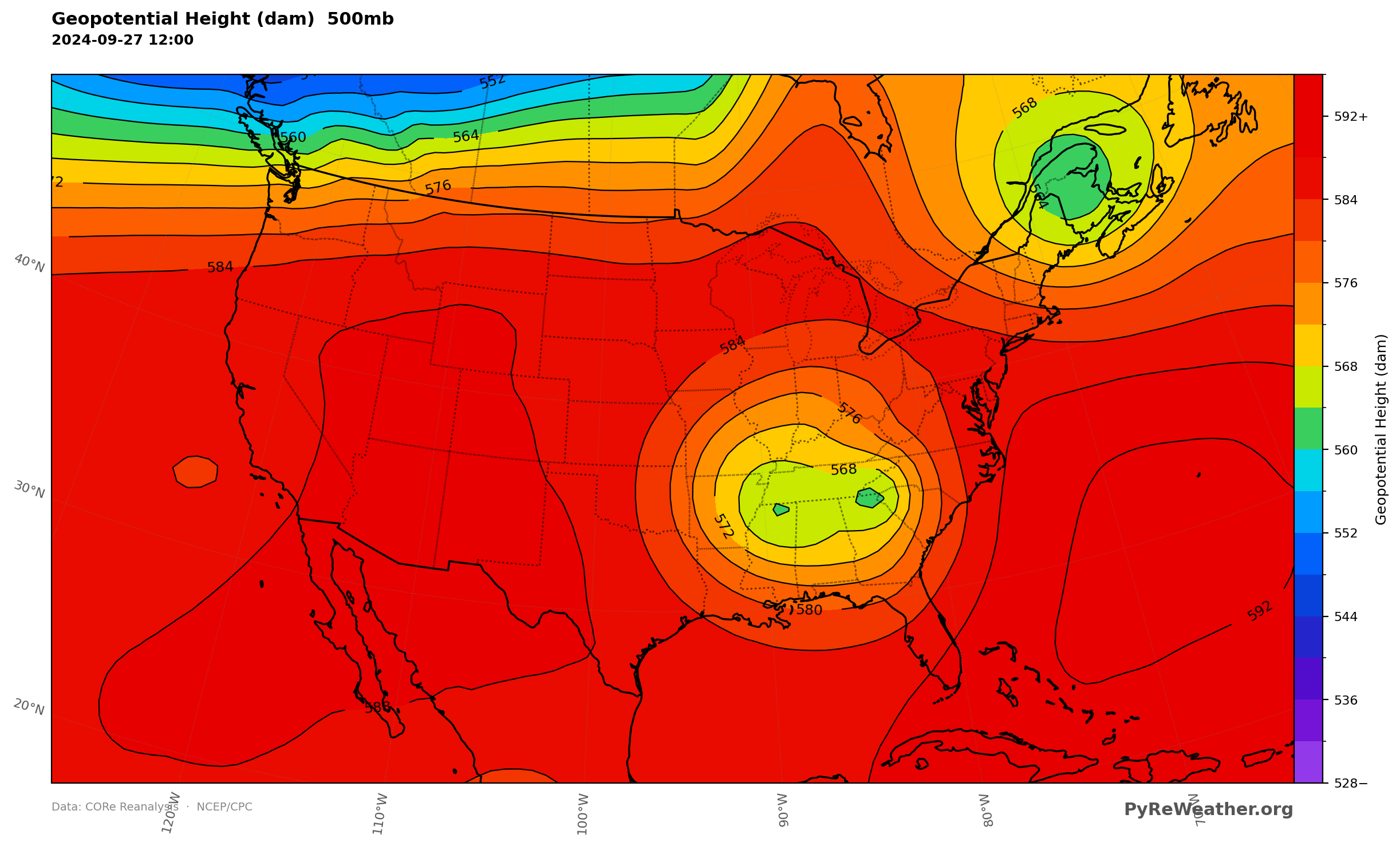
A ridge over the Southwest and Helene's cutoff low dominated the height field.
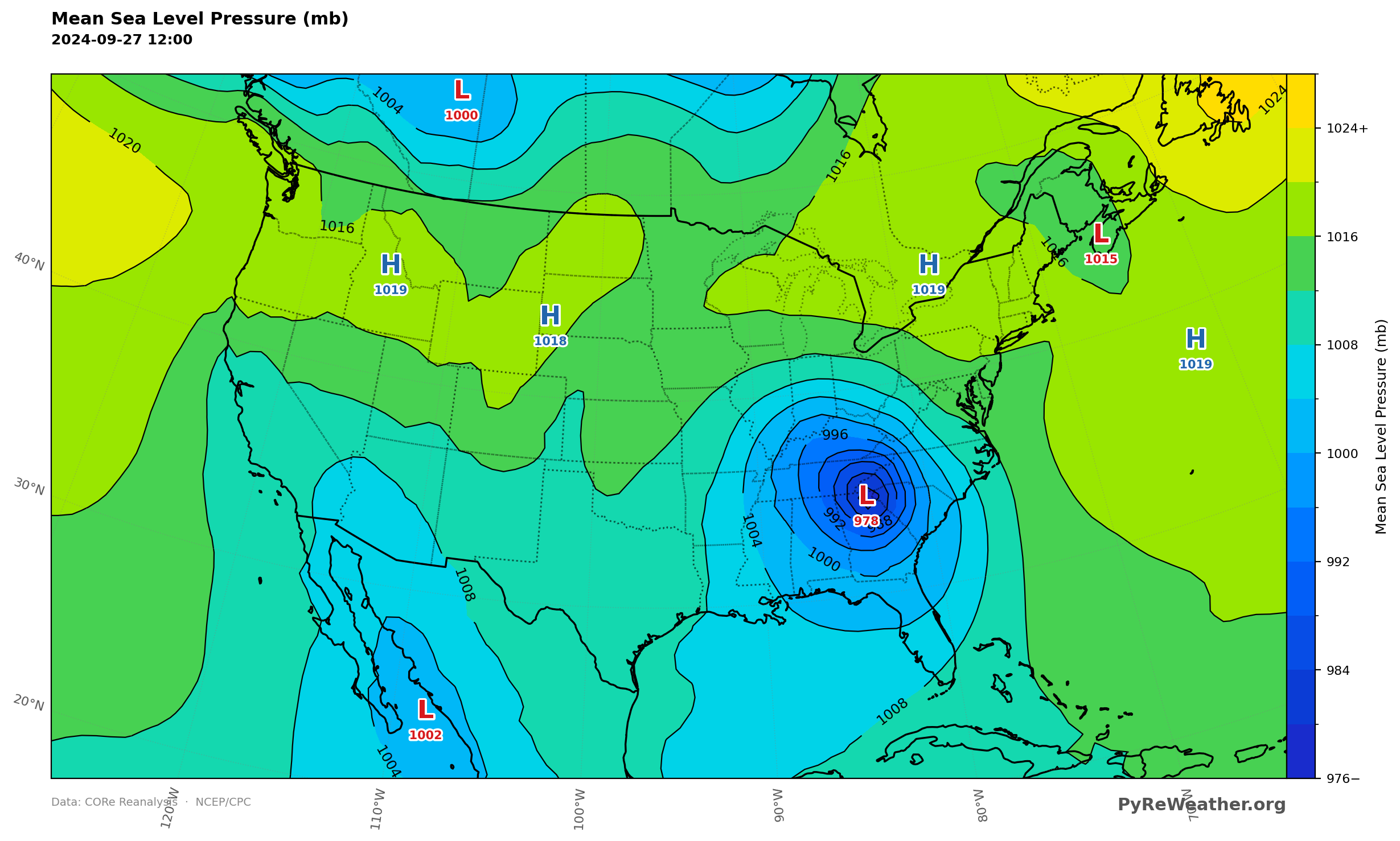
Helene's low center sat over the Southeast, tracking toward the Ohio Valley.
Flooding rains in the Southern Appalachians
Ahead of Helene, a deep river of tropical moisture ran straight up the spine of the Appalachians, with precipitable water values marking a plume that reached from the Gulf into the southern mountains. Rain piled up fastest along the Southern Appalachians and back into the Tennessee Valley, where the WPC hoisted a High Risk of excessive rainfall and warned of severe, widespread flash flooding — even in places that normally never flood. The terrain squeezed still more rain out of that moisture, and the rain simply kept coming as the storm inched inland.
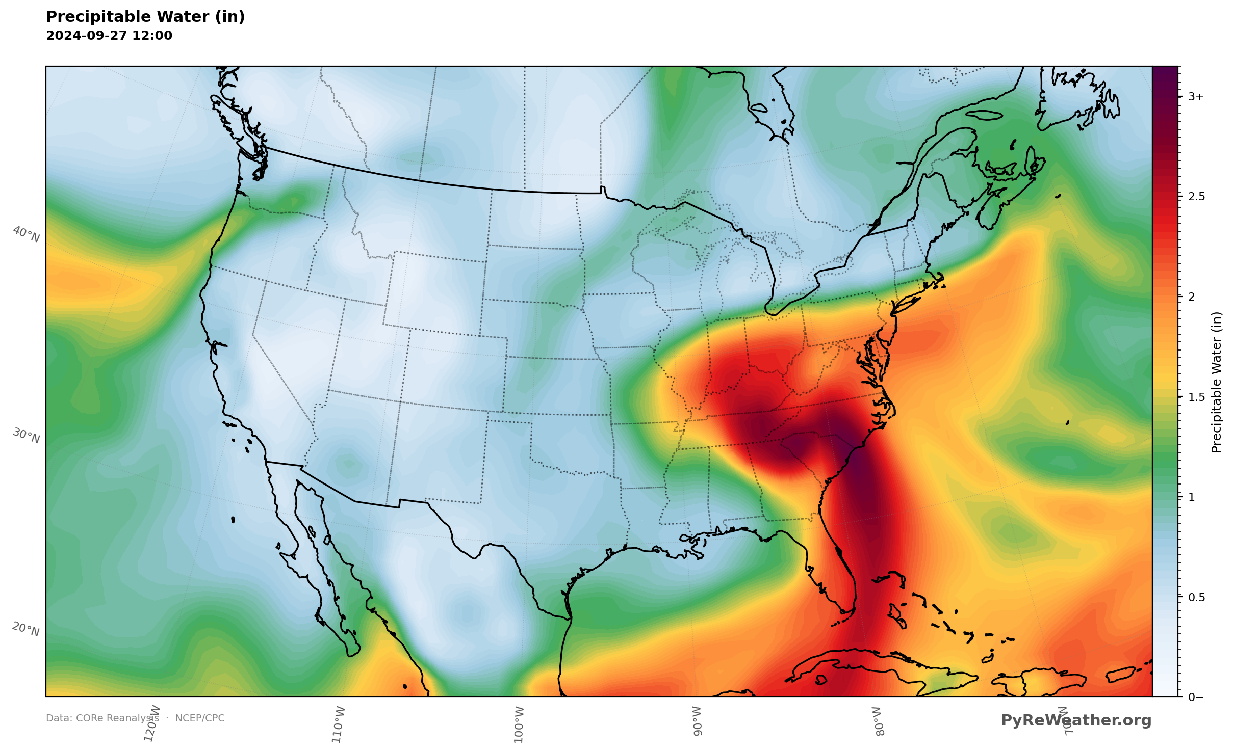
A deep plume of tropical moisture ran up the Appalachians ahead of the storm.
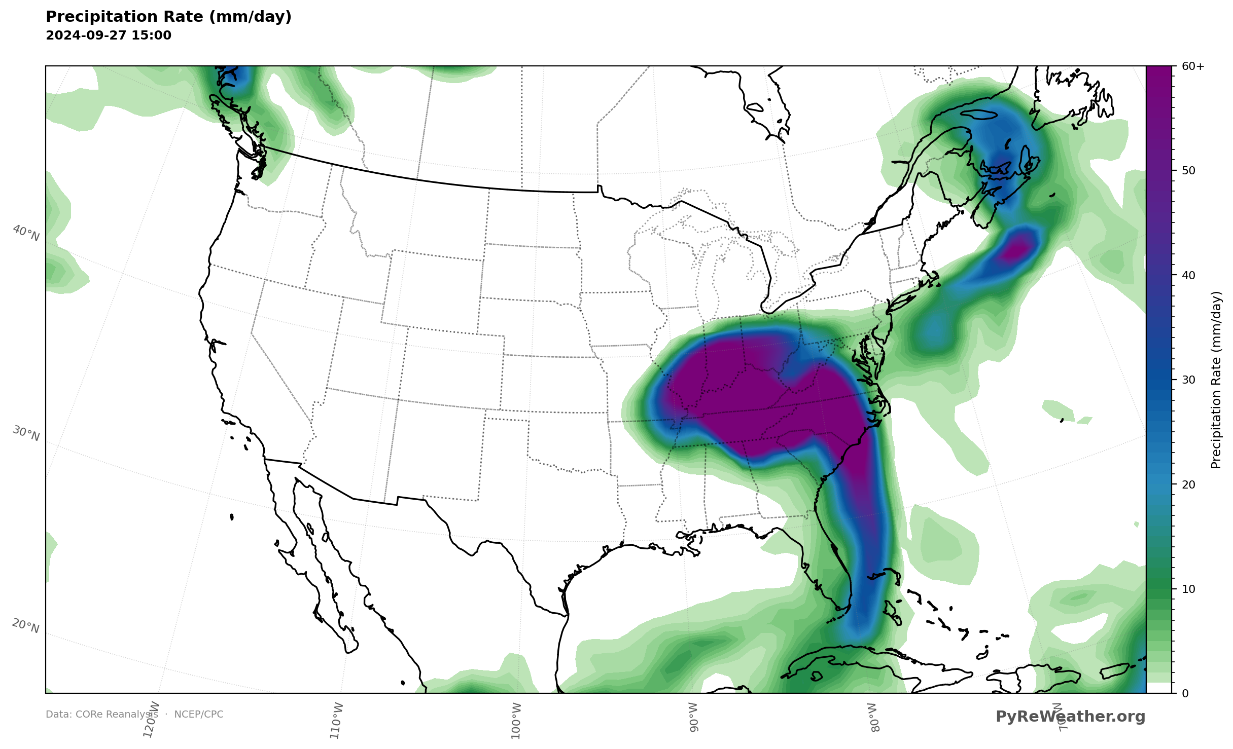
The heaviest rain fell along the Southern Appalachians and into the Tennessee Valley.
Severe storms in the southern Mid-Atlantic
On Helene's eastern flank, unstable air spread across the southern Mid-Atlantic, and it was there the SPC drew an Enhanced Risk of severe thunderstorms. The CAPE field showed the fuel pooling over the region during the afternoon, enough to support frequent lightning and a few tornadoes as storms rotated in off the storm's outer bands.
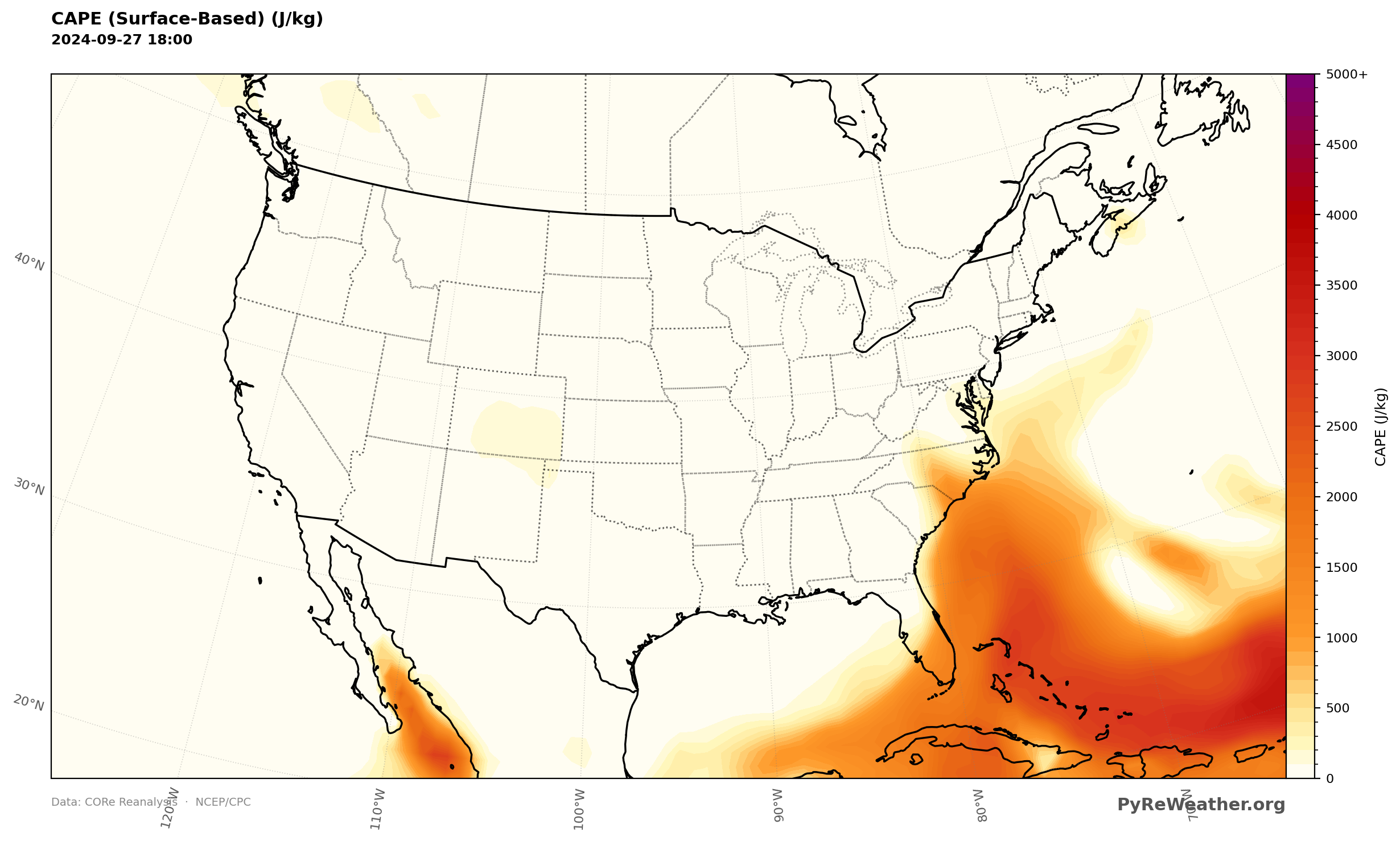
Instability pooled over the southern Mid-Atlantic where severe storms fired.
Dangerous heat in the desert Southwest
While the East drowned, the West roasted. The upper-level high anchored over the Southwest pushed afternoon temperatures from the upper 90s into the 110s across southeastern California and Arizona, and overnight lows only in the mid to upper 80s gave little relief. Excessive Heat Warnings covered parts of southeastern California and the Southwest as the ridge held firm.
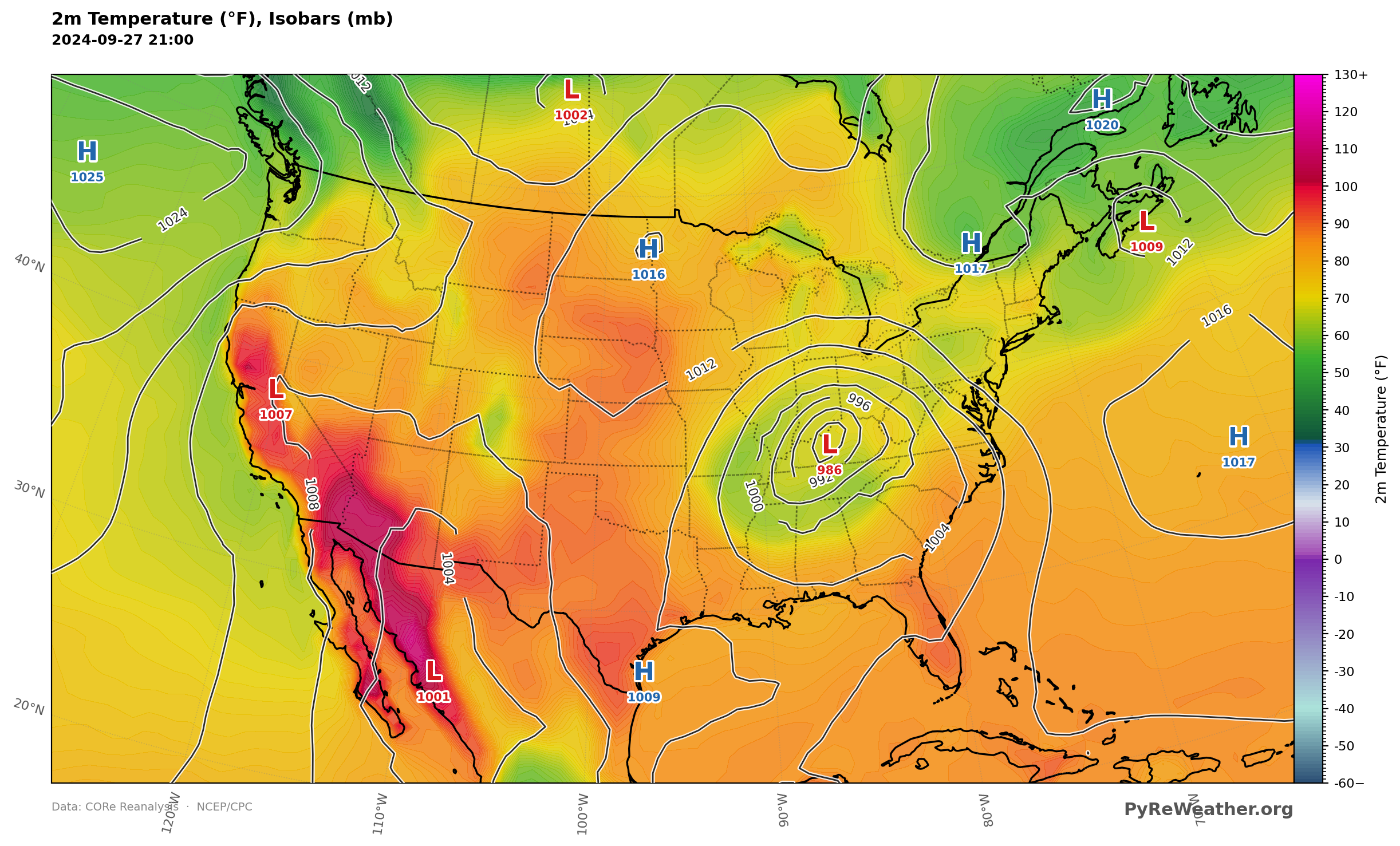
Afternoon readings ran from the upper 90s to the 110s across the desert Southwest.