
Tasmanian Record High Pressure and Winter Desert Rain - Australia Weather, July 6, 2026
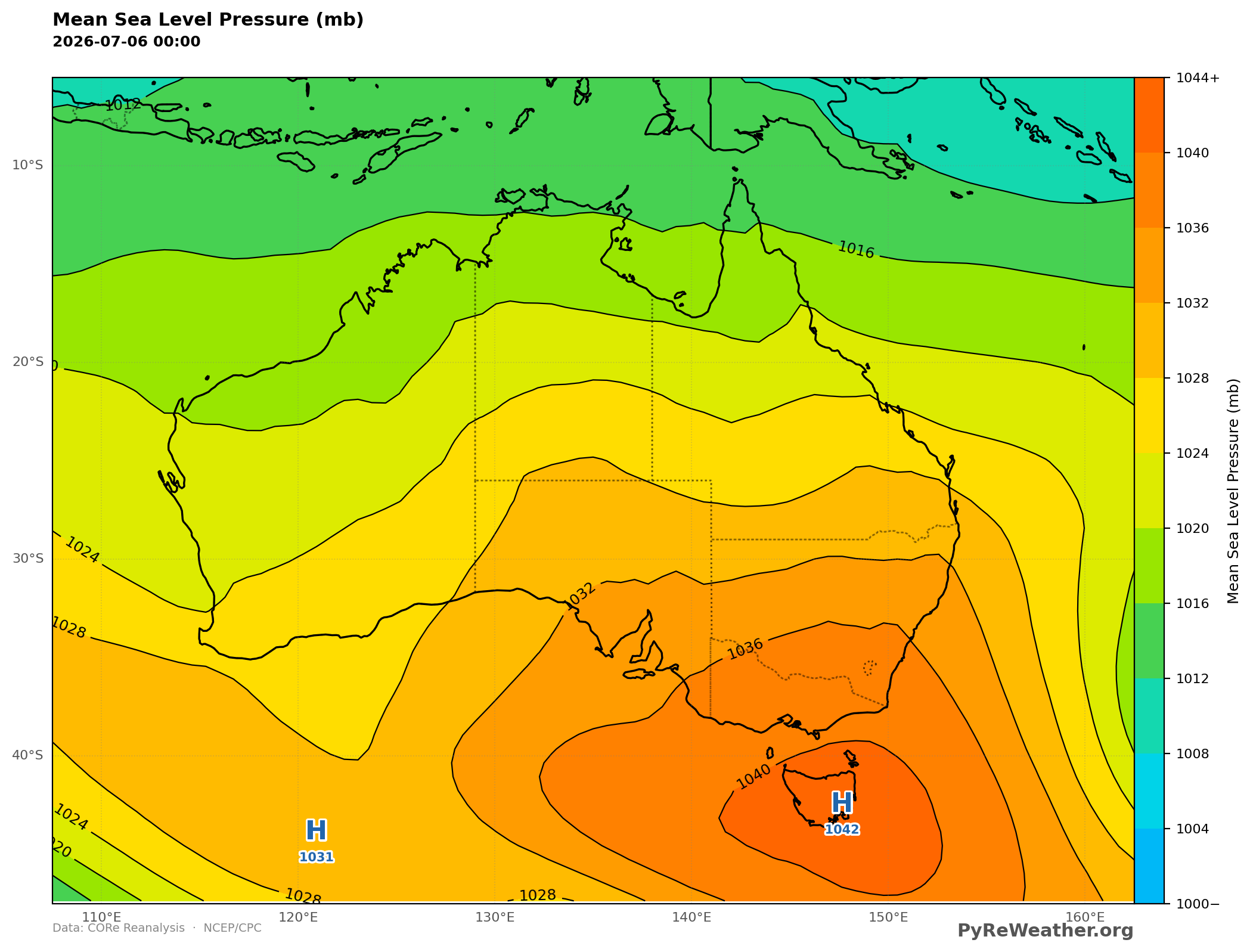
According to the Australian Bureau of Weather, a record surface high pressure was measured in Ouse, Tasmania on July 6th, 2026. We thought it would be...
According to the Australian Bureau of Weather, a record surface high pressure was measured in Ouse, Tasmania on July 6th, 2026. We thought it would be interesting to look at the re-analysis data and some climatologic data for this time of year. It's currently winter in the southern hemisphere, and high pressure systems are often associated with large cold masses of air that is physically denser than warm air. This creates compression towards the surface, creating clear skies with no precipitation.
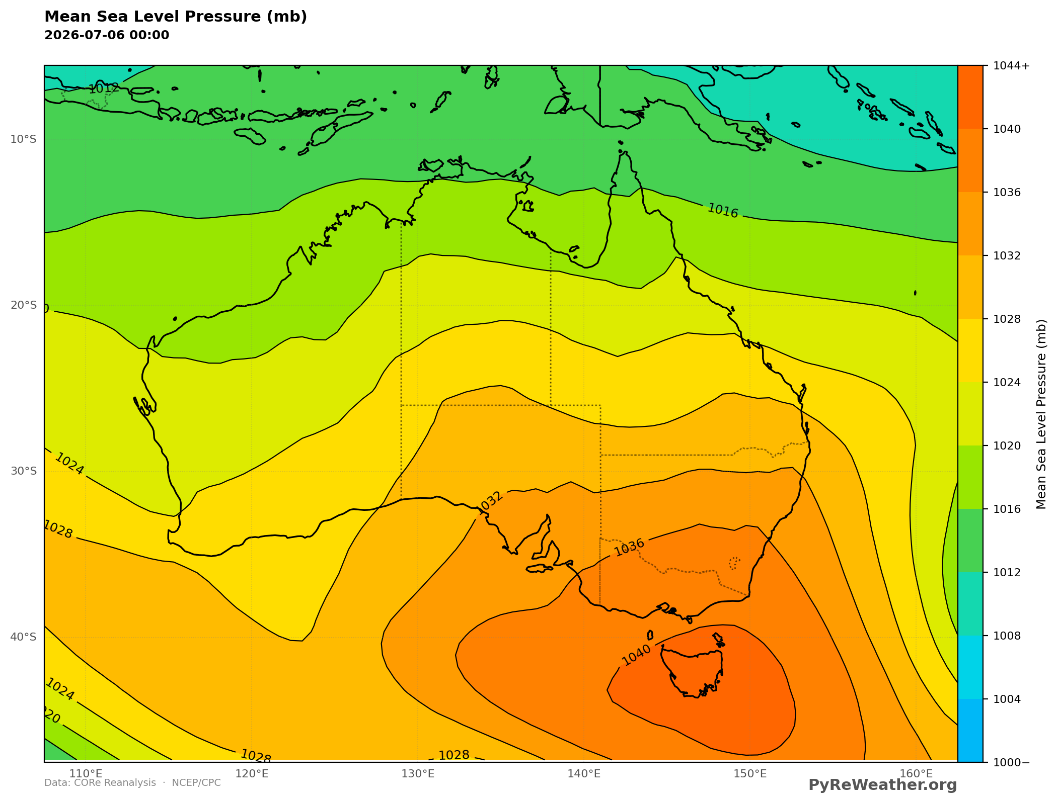
The pressure measured at 10am AEST was 1044.4 mb. In the re-analysis data shown here, exact point measurements may get smoothed out. This doesn't mean that the pressure reading was wrong, only that there are limitations to retrospective analysis when looking at isolated extremes.
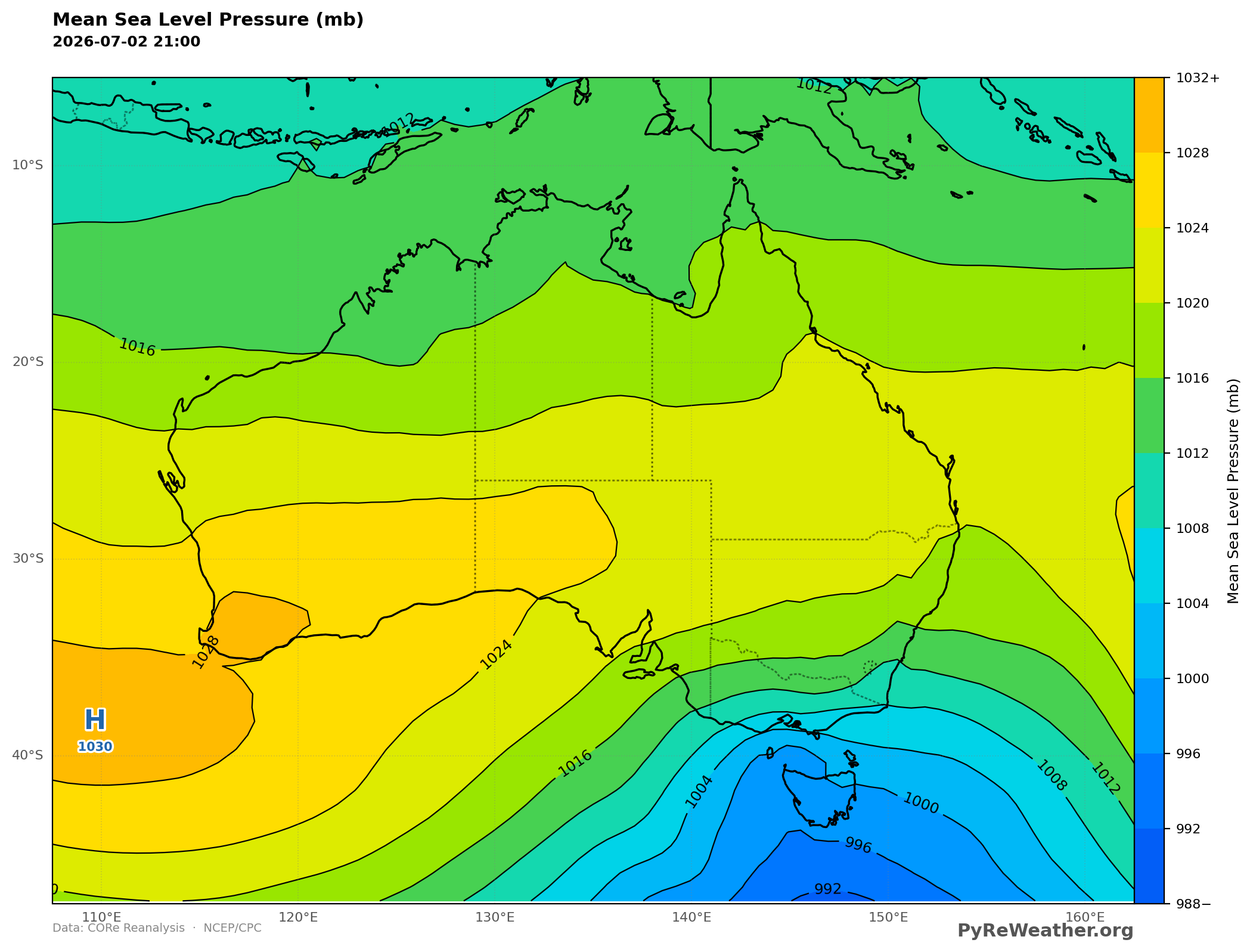
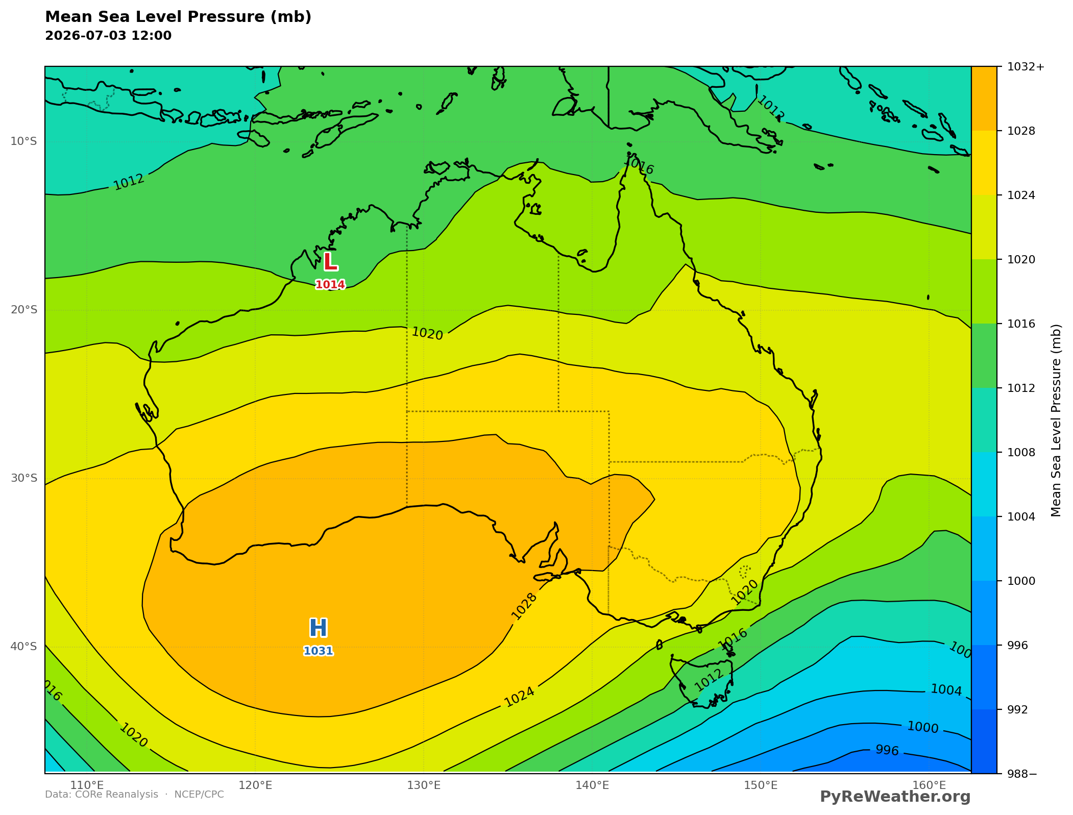
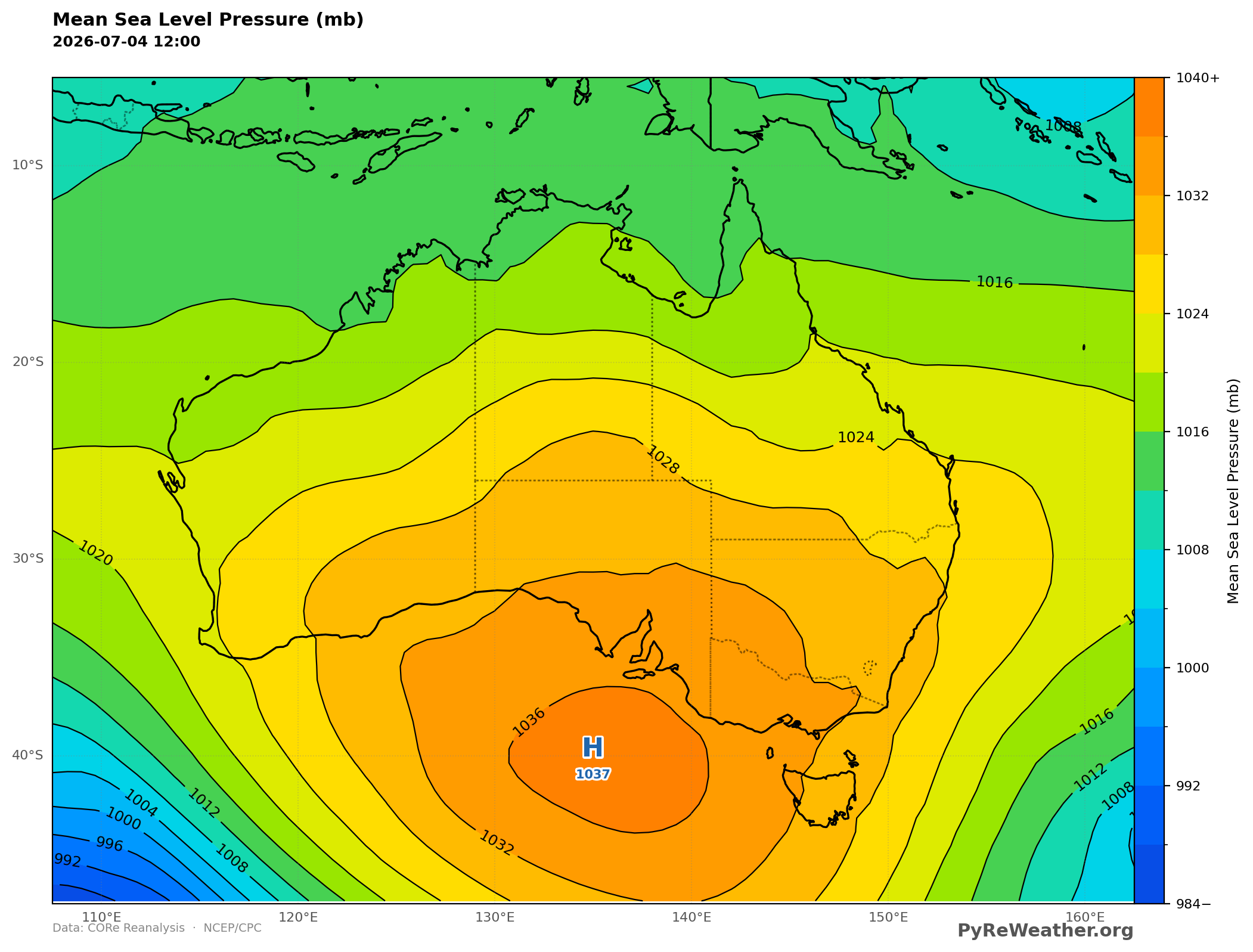
The week before - high pressure moving slowly east
Air movement is dynamic and what's interesting about this pattern is that the high was traveling slowly from the west towards Tasmania piling up more air and stalling this system over the island.
East Coast Rainfall & Isolated Desert Precip
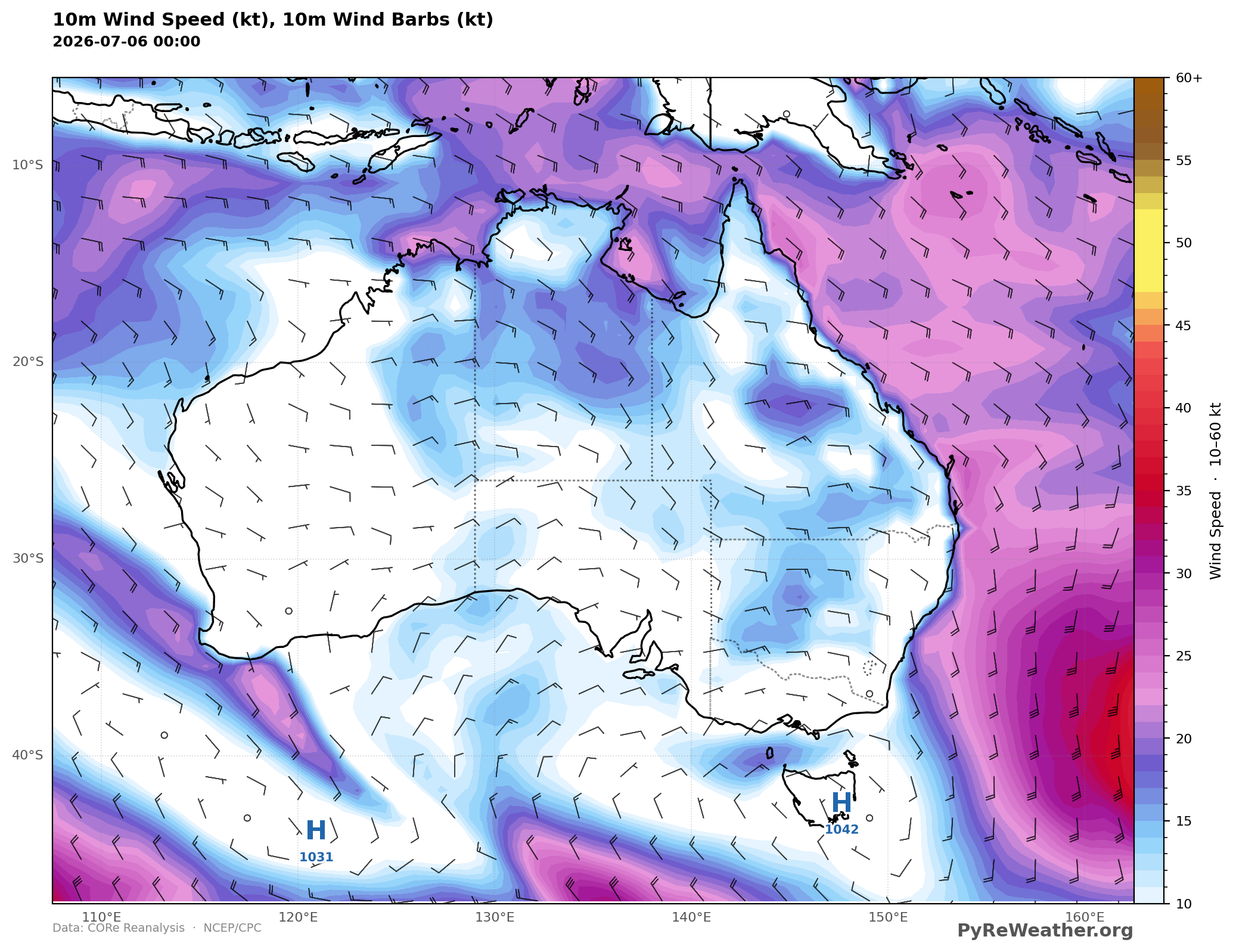
With a high pressure system sitting to the south-east of mainland Australia, the easternmost and northeastern coasts will be hit moist maritime air masses from the south and south-east, while the southern coast of Australia will be experiencing winds from the northeast which are likely to be cold and dry.
One interesting exception is the area of increased precipitation in the middle of Western Australia
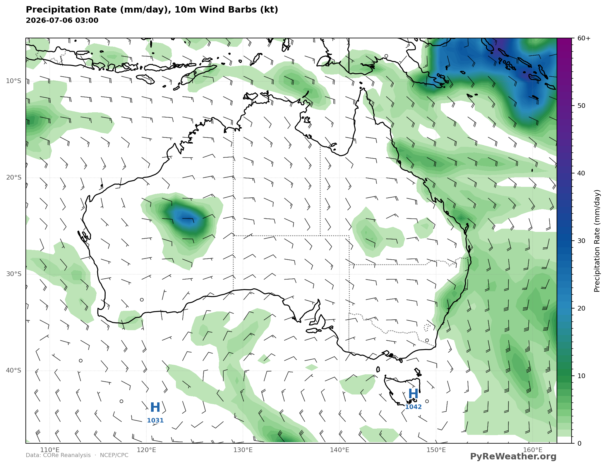
I struggled to figure out where both the moisture and the lift for this was coming from. I could not find any clear low level jets or lifting mechanisms at first.
A Southern Hemisphere Short Wave?
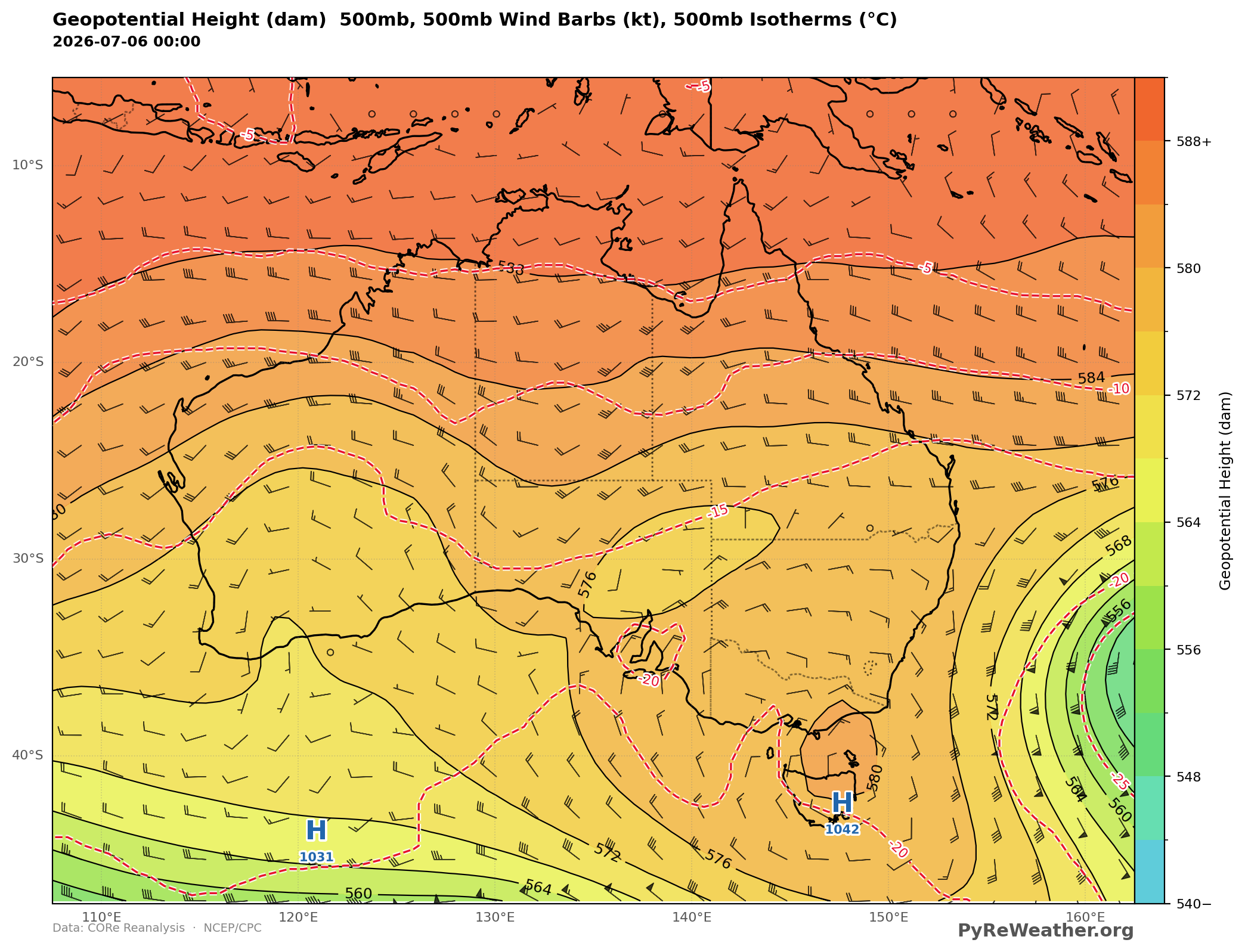
At the 500mb level, i expected to see a short wave or isolated. / cut off low pressure creating a cold core elevated lifting mechanism. But take a look at both the height surfaces as well as the air temps. There is a short wave which could definitely be contributing to lift over the mid western desert region (~25S latitude, 125E longitude). (Being in the southern hemisphere i am guessing that the expected surface lifting will be to the east as well as slightly equator-ward of the short wave but it is a little mind bending to think this through for only the first or second time.
0 - 500mb Wind Shear with 180 degree change in wind direction
What's also interesting here is the surface to 500mb shear. Surface winds are east to ene at about 5 knots. 500mb winds are WNW to NW at close to 30 knots. In fact 700-500mb winds are more westerly than easterly, and what's to the west of the west coast? The ocean
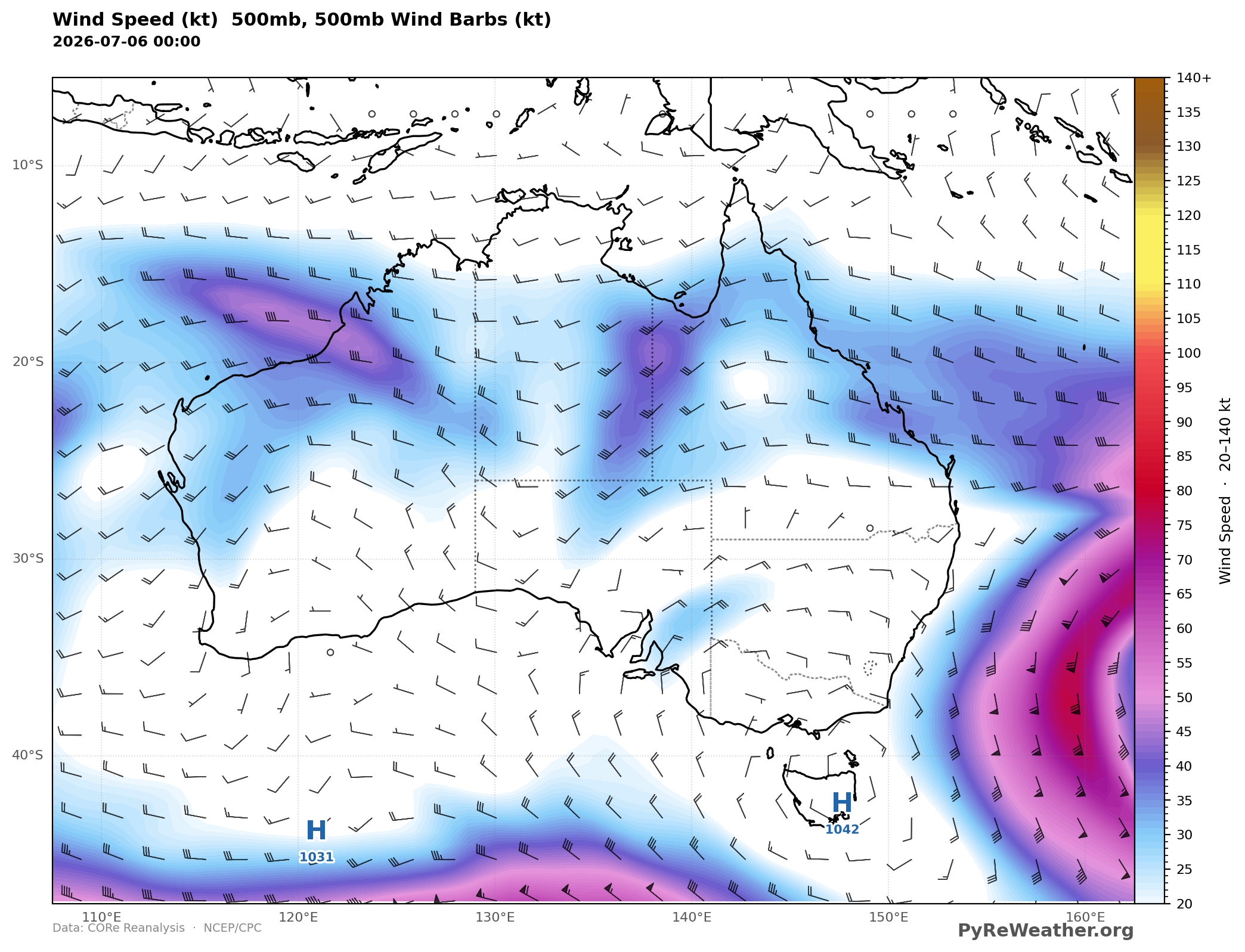
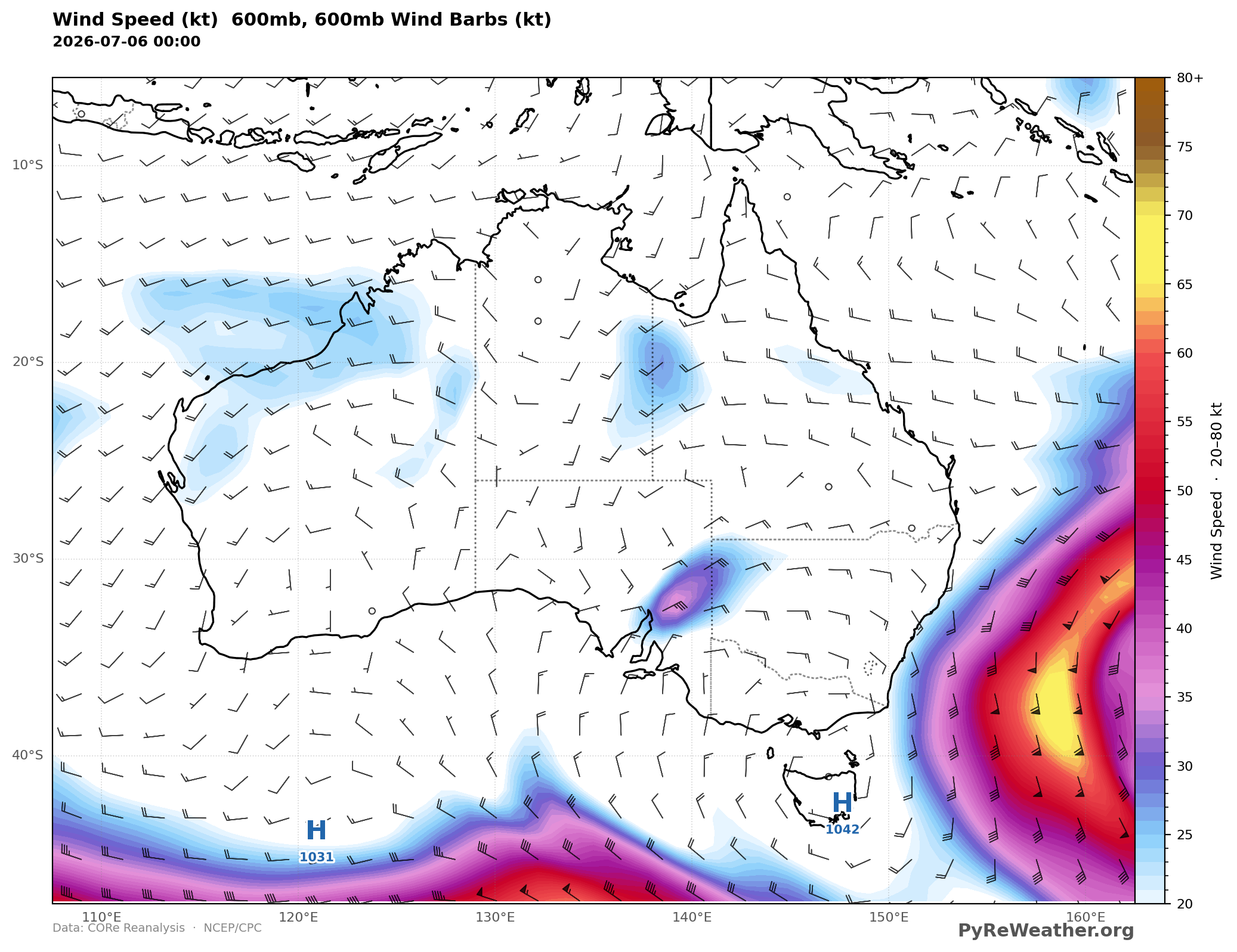
Low level moisture plume from the Indian Ocean
Searching for where the moisture could be coming from, the relative humidity is interesting too. Here is a tongue of increased humidity that looks like it could be brought in from the NW coast of Australia, but the wind speeds are not convincing for the amount of precipitation that occured. I went back to 7-5-25 @ 21Z to see what was going on before the preciptation got heavy.
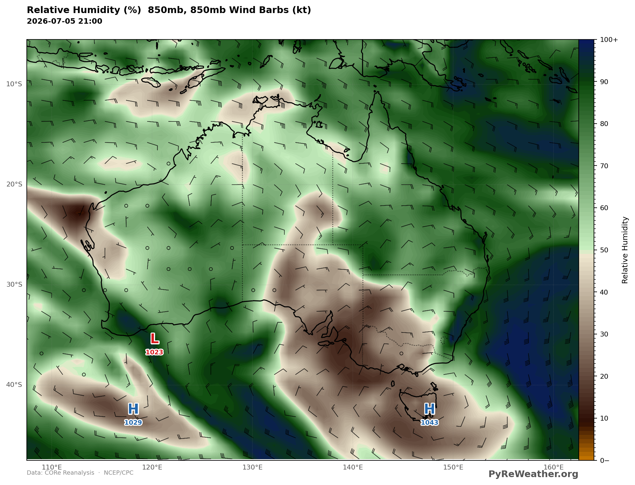
At 700mb and 600mb we have a blob of humid air completely cut off from the arid region around it, which makes me think that there is lift going on here bringing moisture vertically
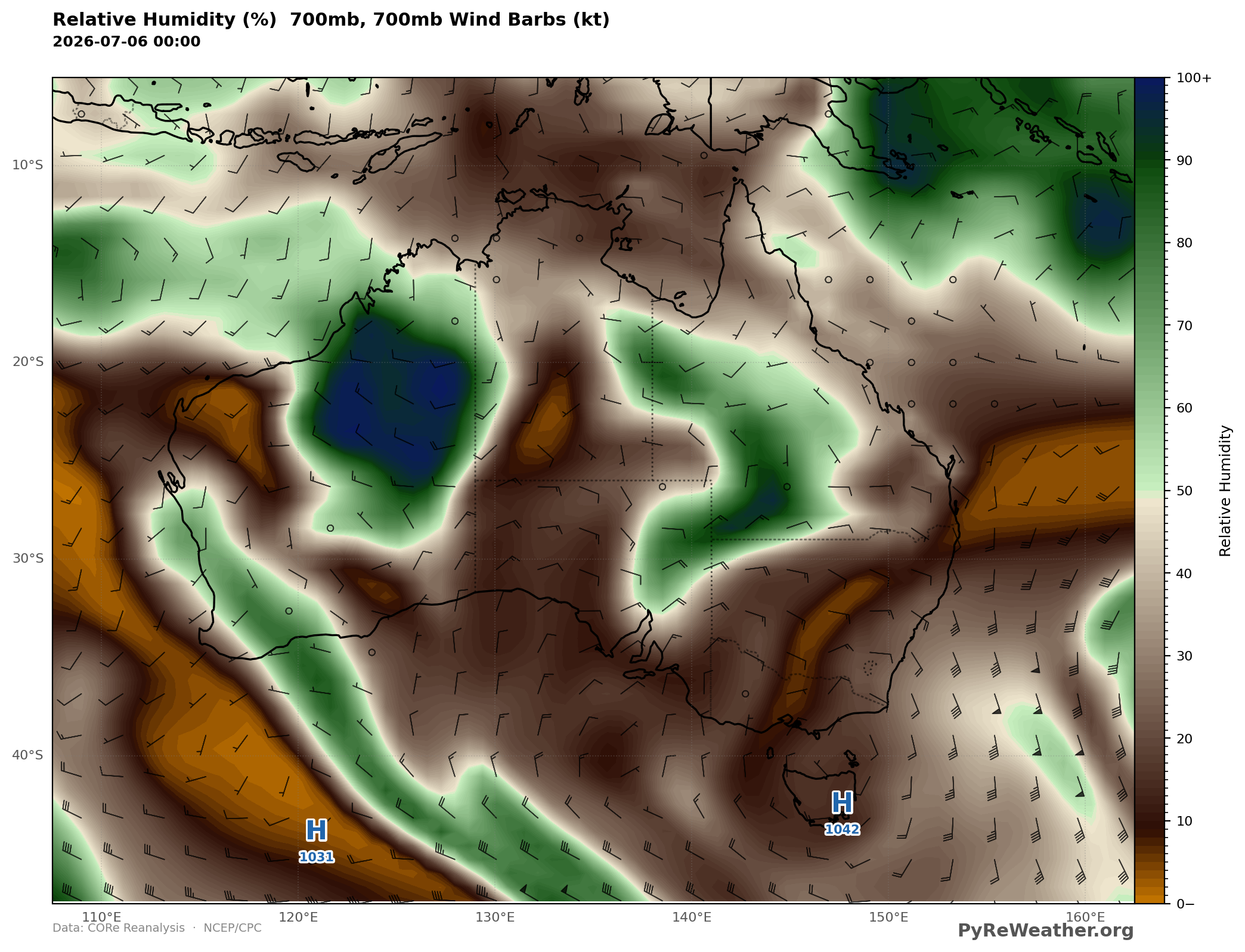
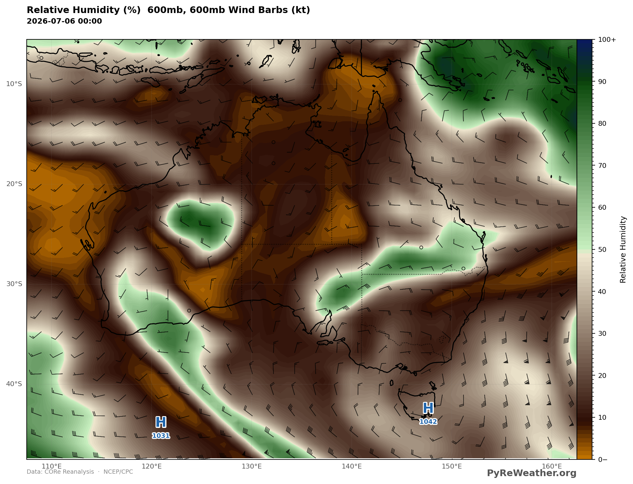
Stratoform rain event, frontogenesis, isentropic lift?
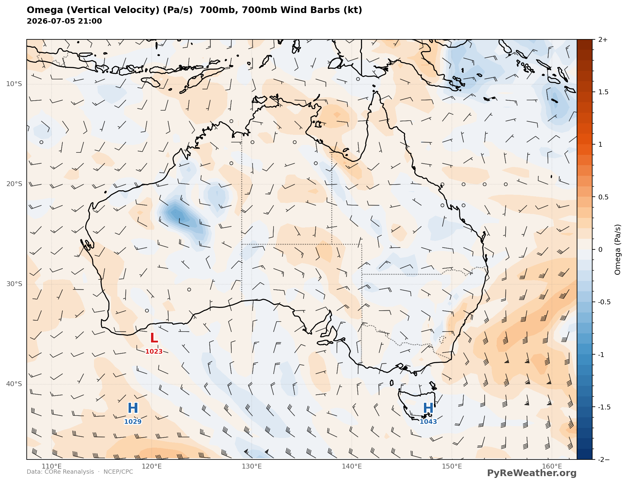
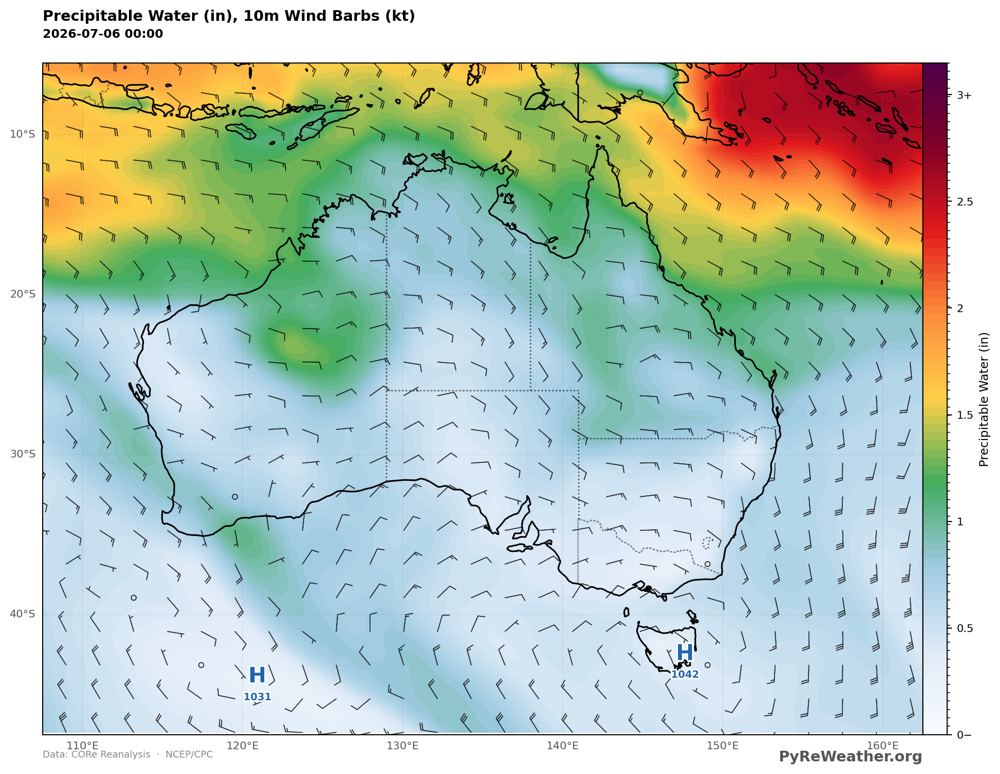
Combining lower level moisture with wind shear suggesting collision of two air masses in the lower mid level, the rainfall here could be the result of a small mid level disturbance creating lift bringing up a plume of moisture which eventually precipitates out. Two final maps to look at... omega (lift in the lower-mid level, and PWAT over the region. Both of these support this theory, but currently PyRe Weather does not create some of the additional maps we need for a full investigation. Which maps should we be adding next?
How Common is Desert Winter Rain in Western Australia?
It's interesting to me that the precip area seems so isolated and inland, so all the ingredients must have lined up just right for lift and moisture for likely high based stratoform clouds creating rain in the middle of the dessert.
There are permanent pools of water in the desert and maybe this is one of the things that fill them up.
All maps in this post are created with PyReWeather. You can start here and generate any of the maps seen in the post by choosing the variable you're most interested in