
Historic Rainfall and Flooding Event December 2015
Over three days, from December 26 28, 2015, nine to twelve inches of rain fell in the St. Louis metro, causing substantial flooding in the region....
Over three days, from December 26-28, 2015, nine to twelve inches of rain fell in the St. Louis metro, causing substantial flooding in the region. Interstates 70, 44, and 55 were closed in multiple locations due to the flooding, making travel into and out of the metro area very difficult and dangerous. Below is a reanalysis of the big picture atmospheric conditions at the start of this event.
Jet Streak lifting and divergence in the right entrance region
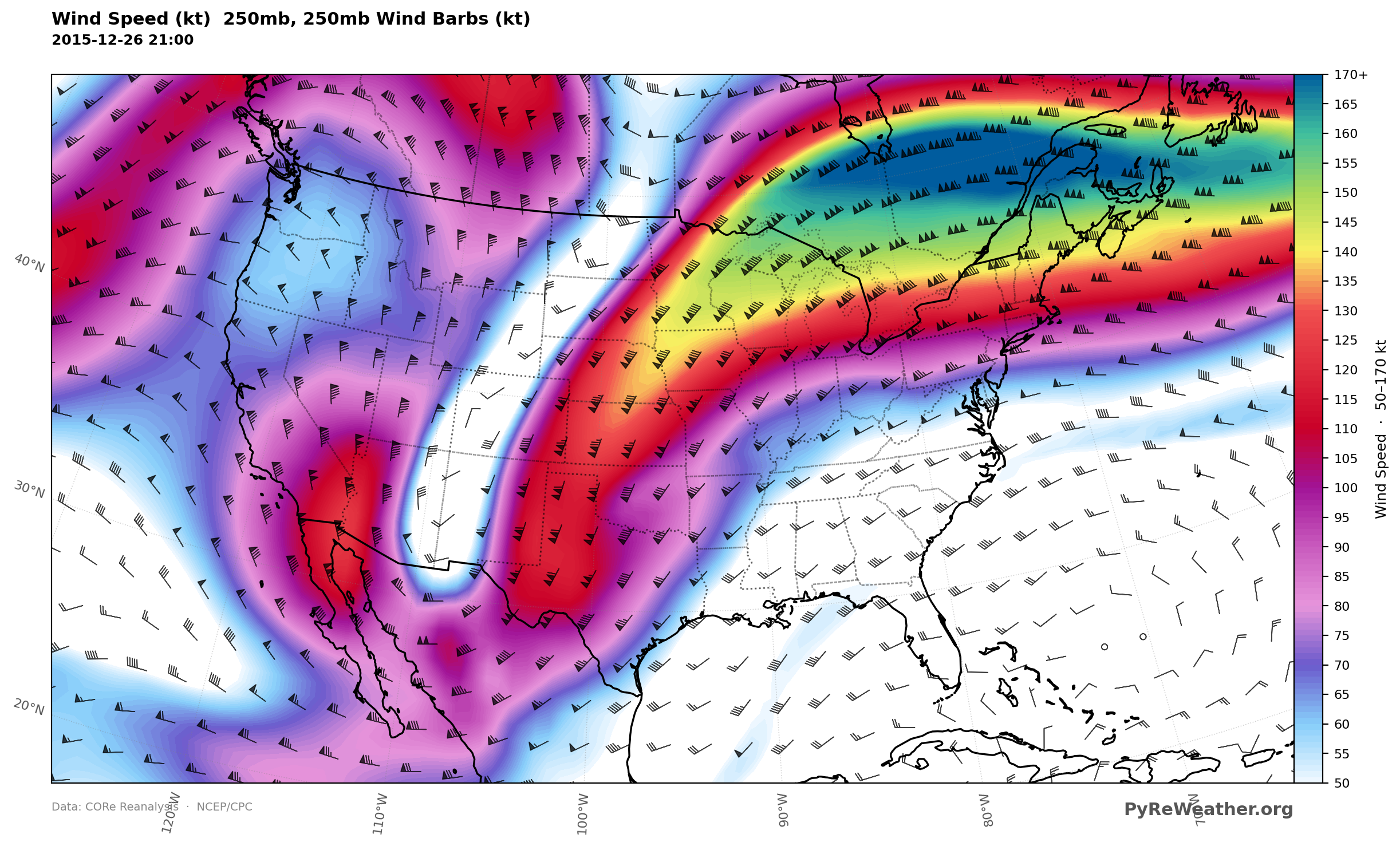
St. Louis was situated in the right entrance region of a relatively strong 250mb jet streak, making for relatively strong divergence aloft. This divergence provided relatively strong lift in the upper troposphere.
Positive Tilt Trough with Mid-Level Divergence
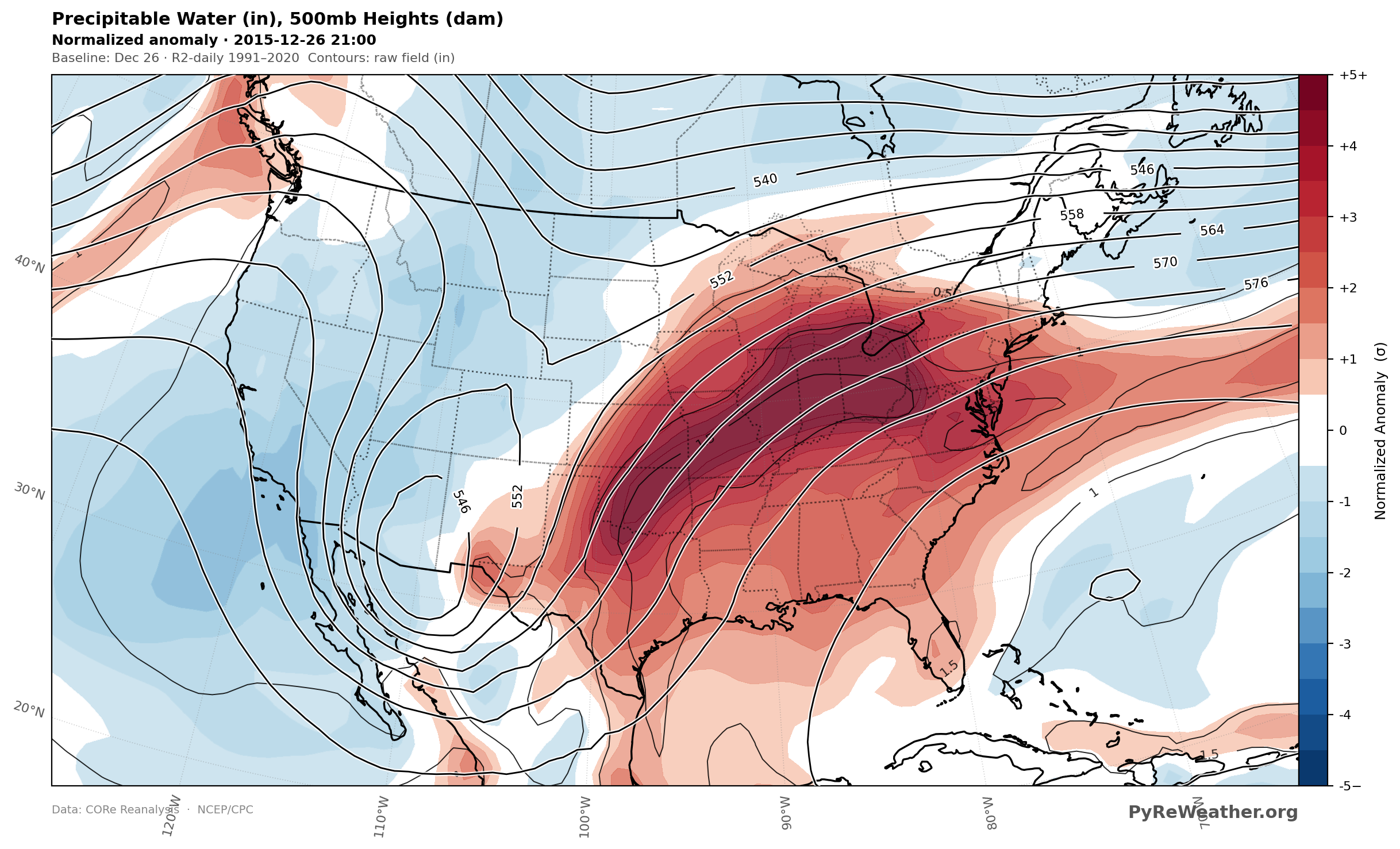
Looking at 500mb, a strong, positively tilted trough approached the region, amplifying mid-level divergence, deepening the low-pressure system. Normalized anomalies of precipitable water were over 4 standard deviations from normal. This is rather notable, as anything above 3 standard deviations occurs only about 0.3 percent of the time.
Low Level Moisture Transport from the Gulf
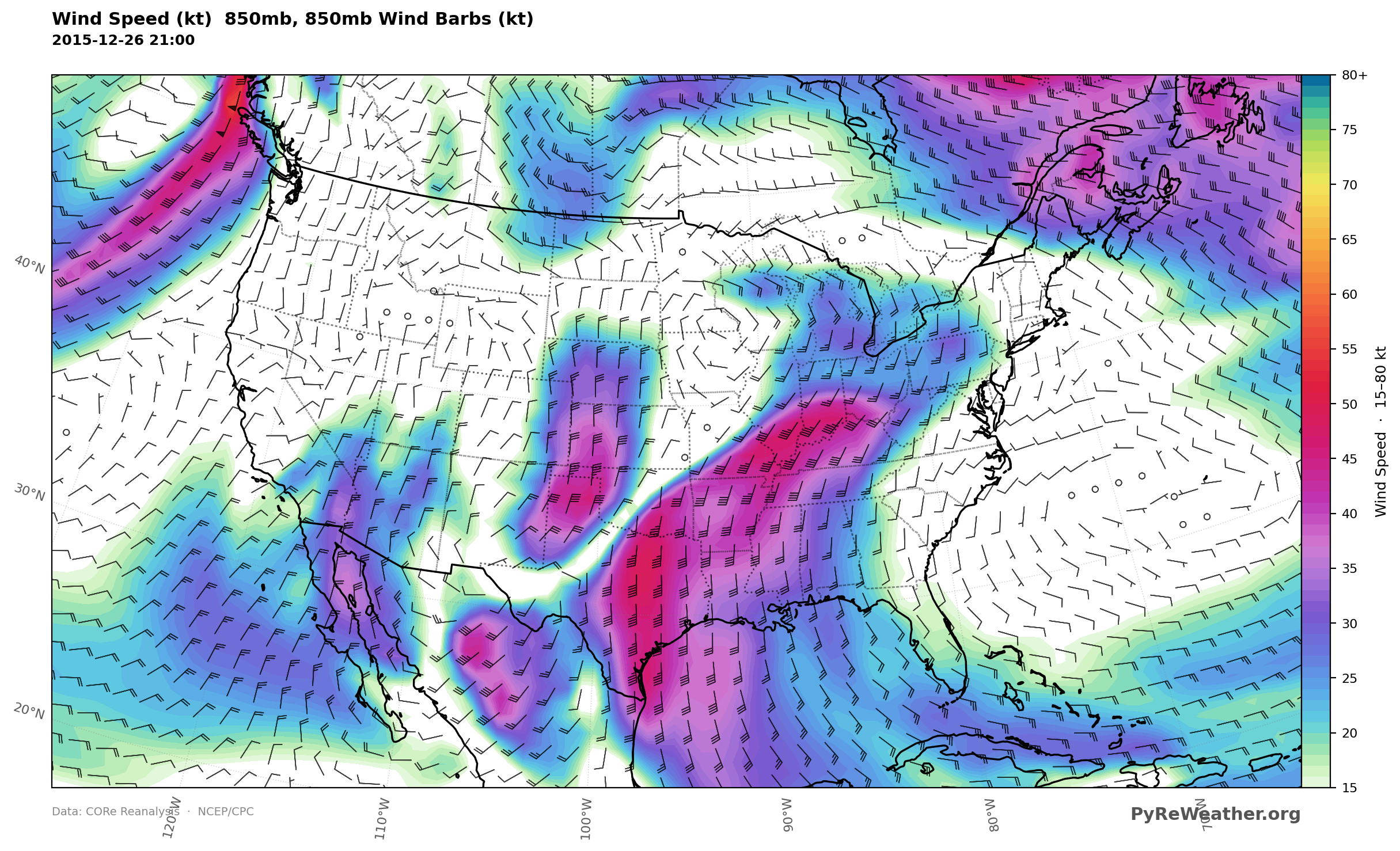
A low-level jet was present at 850mb with St. Louis situated in the left exit region, favoring additional lift in lower levels of the troposphere. This jet also helped to transport moisture from the Gulf of Mexico, further increasing the amount of available moisture in the region.
With lifting mechanisms present at all levels of the troposphere and significant moisture available, the stage was set for this to become a historic rainfall event.
Synopsis Post contributed by Forecaster Ashley Birk.